SCOTLAND
In 2022, I walked the West Highland Way, a 96 mile walking trail from Milngavie (mull-guy), a suburb of Glasgow, to Fort William, which is where the highlands begin. I first heard of the Way from a fellow hiker some years back while staying at an Appalachian Mountain Club lodge in the White Mountains. Because of the number of nightly stays and logistics involved, I went with a tour operator, Macs Adventure, to plan the accommodations and baggage transfer.
I chose May to do the 7 day walk because May was supposed to be a month when the rain was not as frequent as in other months. Nevertheless, it rained nearly every day. May was also a desirable time because it preceded the season when midges became active.
At the start of the trail, it felt as if I was part of a group because there were so many others starting the trail at the same time even though I was a solo hiker. But as the days progressed, the trekkers became more spaced out along the trail. It is a busy trail that many aspire to do. Some of the locals I met spoke of other worthy trails to explore in Great Britain. I hope to go back.
The first batch of photos are from the West Highland Way. After finishing in Fort William, my daughters joined me and we drove up to Portree (por-tri) on the Isle of Skye, where we enjoyed some day hikes and awesome scenery.
The West Highland Way

The obligatory selfie at the beginning of the trail, taken on a Sunday afternoon when there was almost no one around.

Not far from Milngavie, once out of the suburb and through a stone fence, you enter open territory. Here, you are greeted by a shaggy highland cow nursing a calf.
Accommodations (upper left window apartment) in Dryden, the first day’s destination after leaving Milngavie. 12 miles.

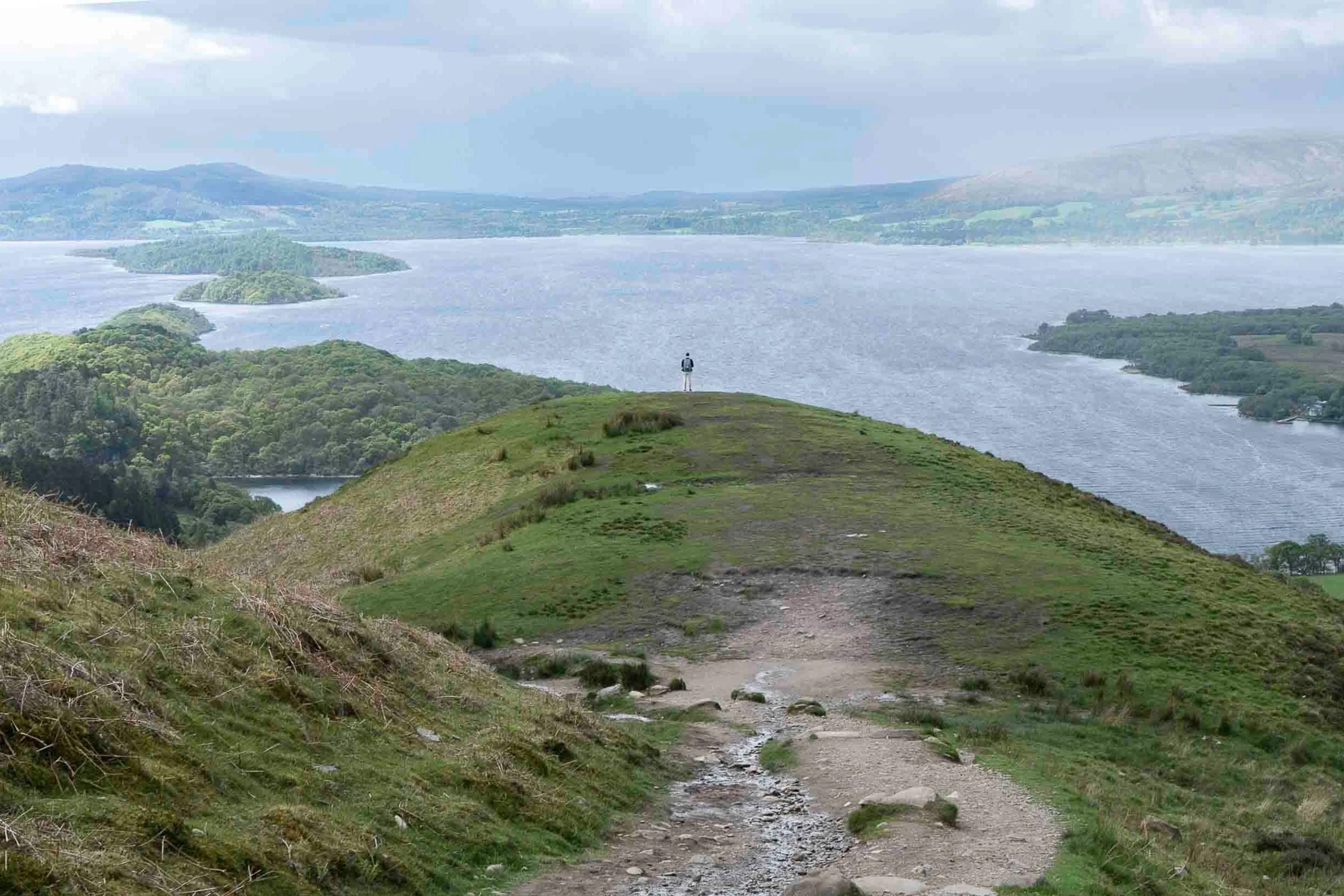
The view from the top of Conic Hill. Very windy conditions.

Coming down from Conic Hill with Loch Lomond in the background.

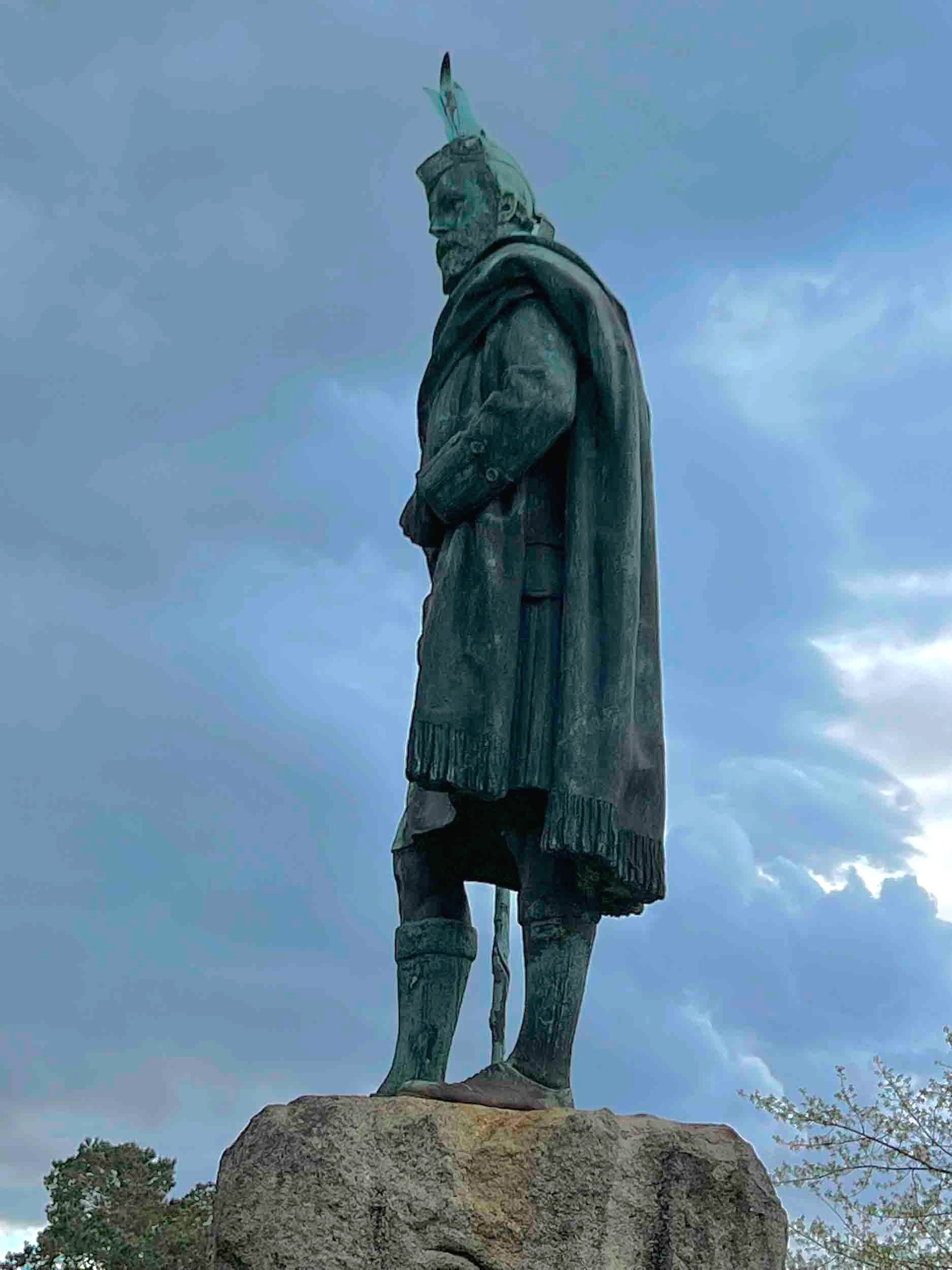
Statue of Tom Weir, Scottish climber and explorer, located at Balmaha. There is a small park there that is ideal for a break or lunch after descending Conic Hill.

After leaving Balmaha, a pose on the shore of Loch Lomond, taken with a cell phone.

LOCH LOMOND NATIONAL PARK MEMORIAL SCULPTURE dedicated to those who gave their lives in the First and Second World Wars. Unveiled in 1997. On a clear day, the point in the circle directs the view to Ben Lomond.

Rowardennan Hotel, 14.5 miles from Dryden.

Feral goat in the tall weeds along the northern end of Loch Lomond.
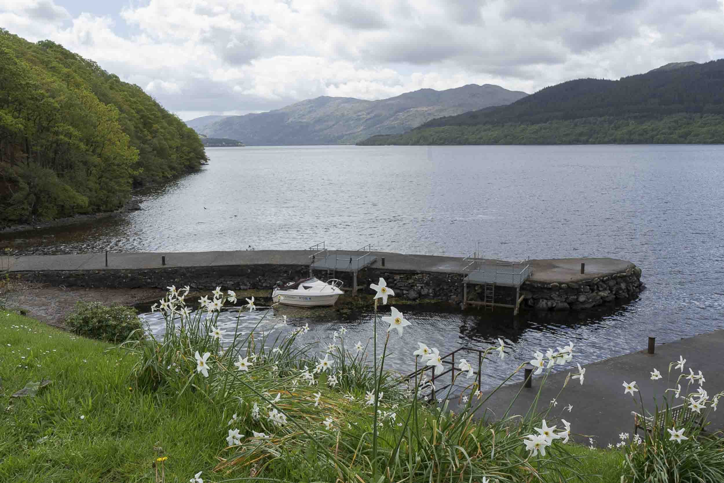
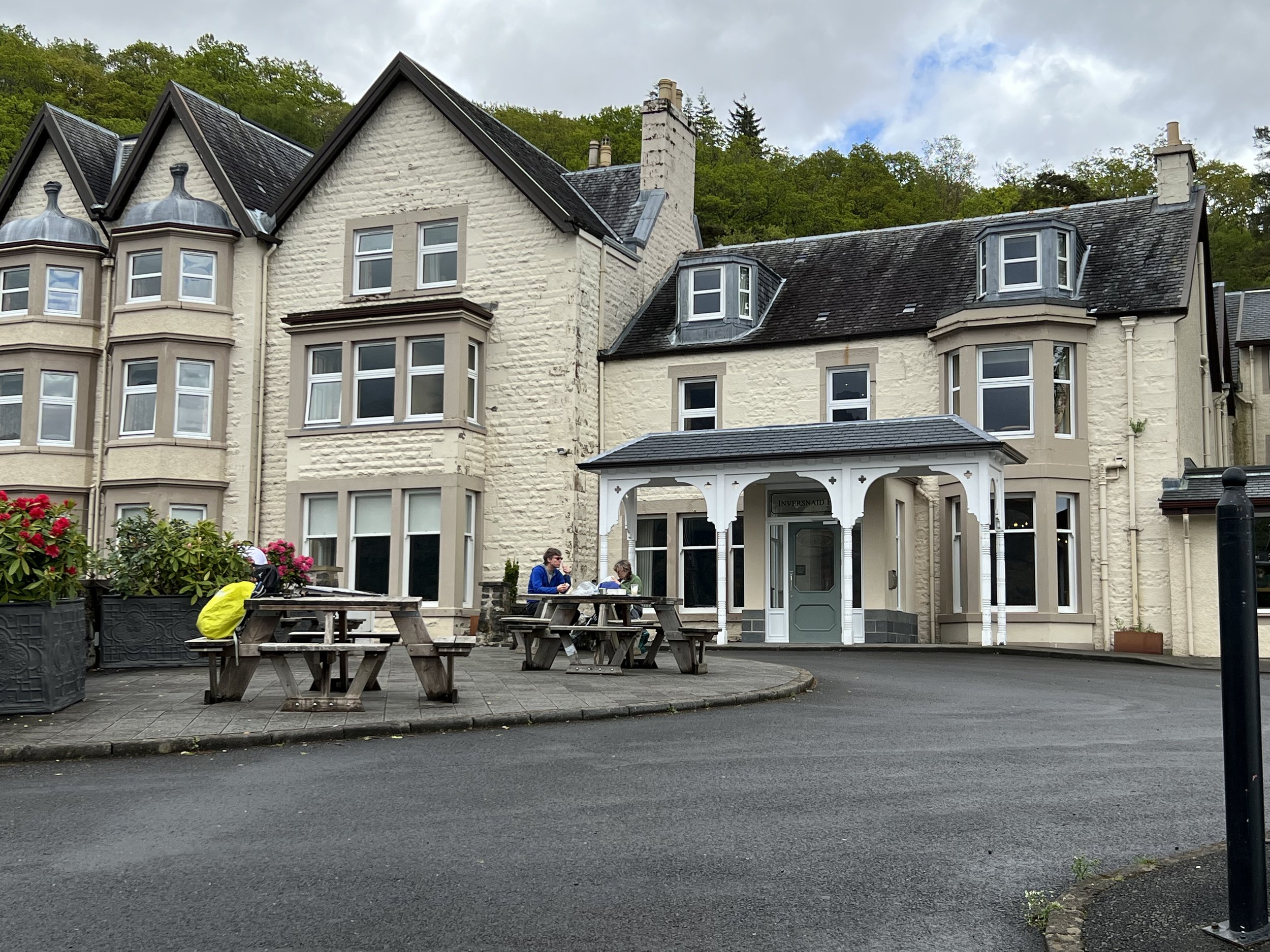
Inversnaid Hotel and boat launch was a good place for a lunch break between the Rowardennan and Ardlui Hotels—Ardlui being at the north end of the Loch. This section of the trail required a good amount of going up and down to negotiate the rocky coastline of Loch Lomond.

A first class pier for the ferry that transports you to the Ardlui Hotel on the other side of the loch. It was secure enough, though.

To notify the ferry boat on the other shore that you were waiting for a ride to the hotel(s), you had to use a rope to hoist the red ball to the top of the pole and wait for its arrival.

The Ardlui Hotel, where I had a wonderful salmon dinner with a very refreshing draft beer.

I loved the interior of the Ardlui for its blonde wood and purple plaid carpeting.

The view without rain, of the area in front of the Ardlui

The Coral Anne, the ferry boat, bringing in another load of tired and hungry hikers from the other shore.

After hiking many hours in damp, cool weather, some simple things in your room like a couple of shortbread cookies to greet you and a Hobbs electric teapot to make hot tea make you feel like the hotelier has an appreciation for how arduous your day has been.

After breakfast at the Ardlui and taking the ferry back to the trail on the other side of Loch Lomond, a steady rain ensued, evidenced by the running water on the trail, shown above. The building on the right is the Doune Byre Bothy. A bothy is a building that hikers can use to sleep in or take shelter as the case may be.


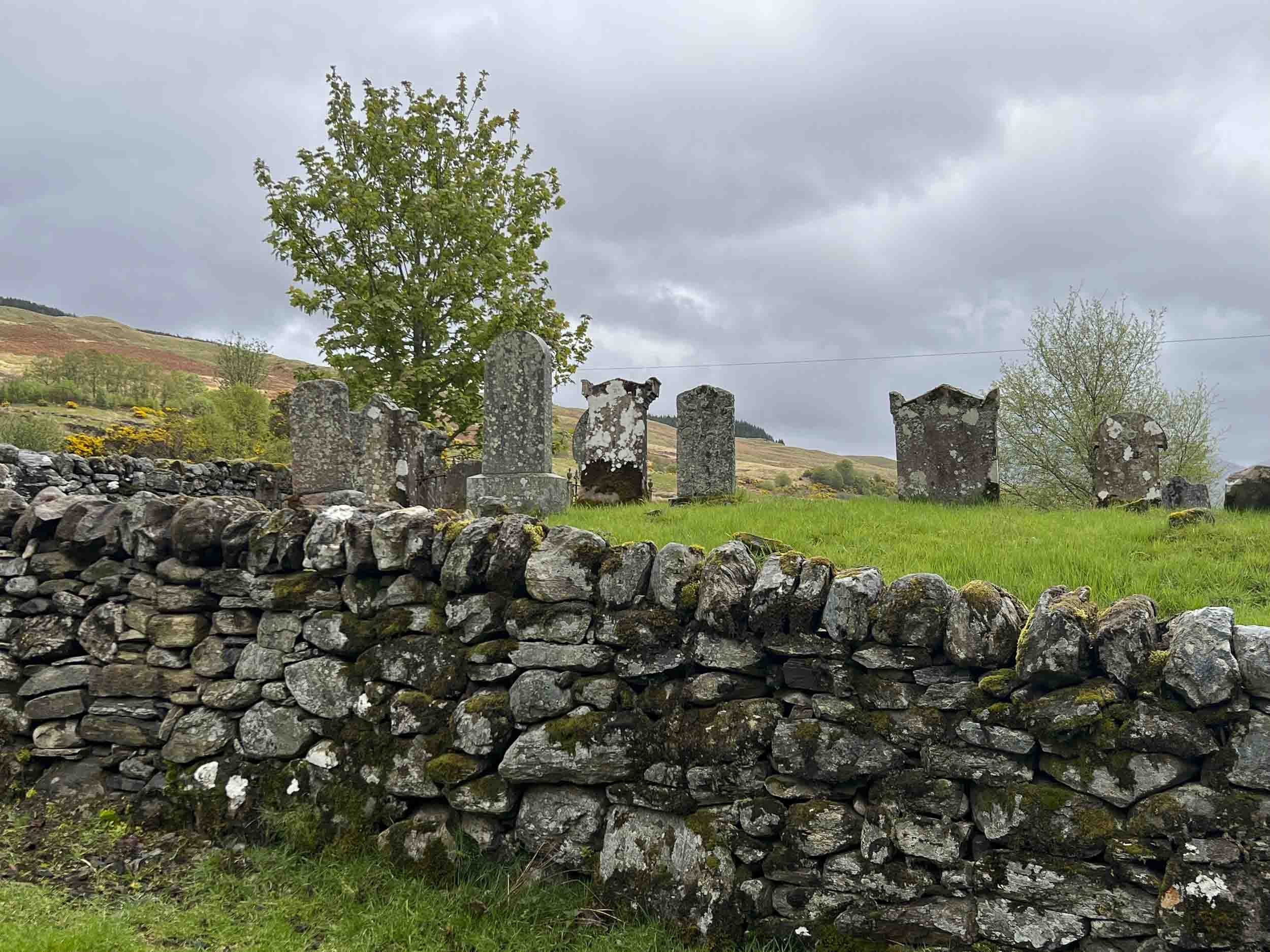
On the way to Tyndrum (tinedrum), the trail passed a site where St. Fillan priory (monastery) was established by Robert the Bruce in 1317. Next to the ruins is a ancient cemetery.

Black face sheep with young lambs were common along the trail at this time of year.

As the trail approached the town of Tyndrum, many, many trees had been cut down over large swaths of land. The reason was apparently to contain the spread of disease from infecting the remaining forest stands. The need for timber in industries such as ship building reduced the amount of wooded land in previous centuries, causing the amount of forested land to be greatly reduced over time.

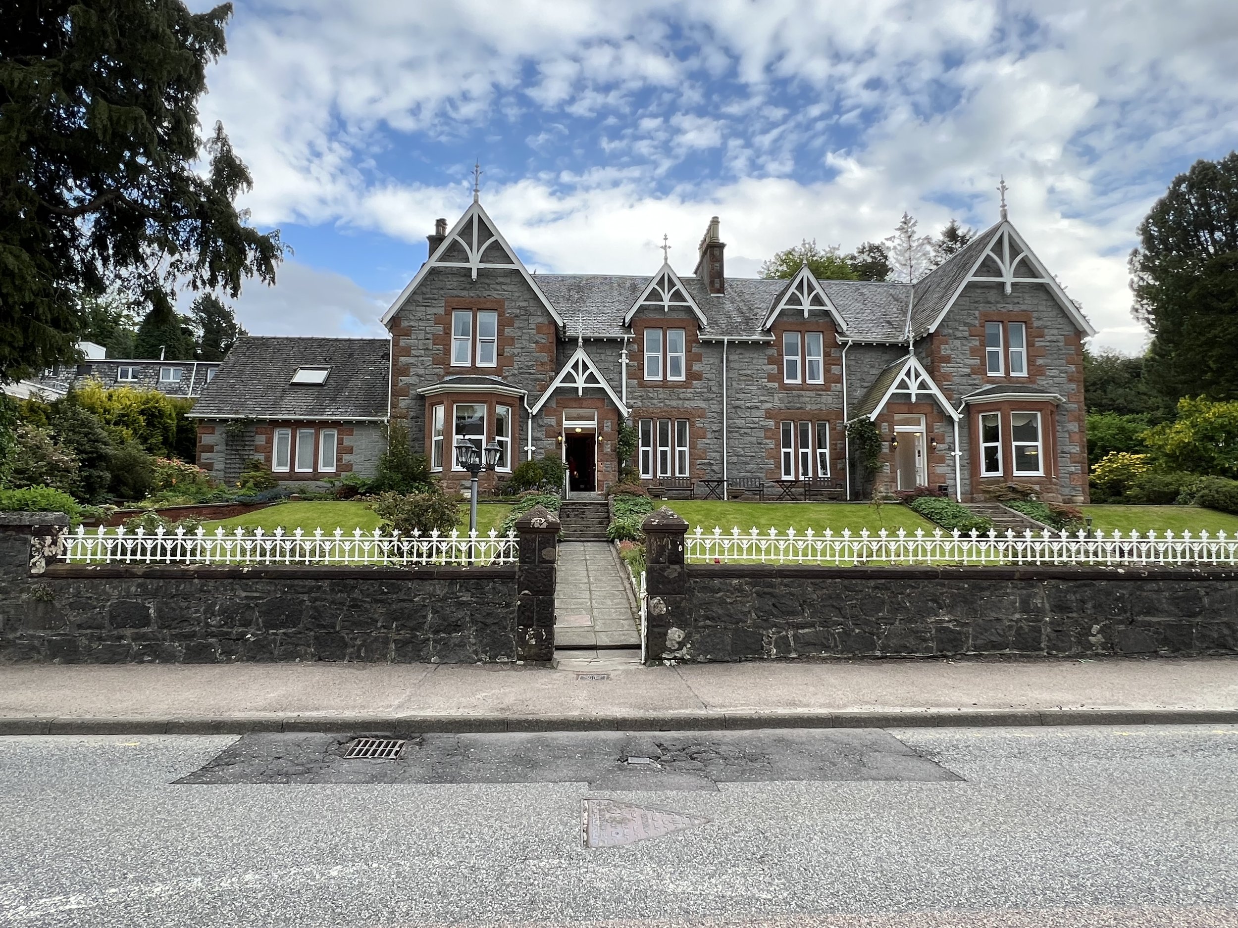
Tyndrum Motor Lodge, 12 miles from Ardlui.

The Green Welty was an essential stop for many hikers who needed to stock up on provisions for the next portion of the hike because there were no stores for food or water till Glencoe Ski Center, the next destination on the Way. Tyndrum to the Glencoe Ski Center was also the longest day’s walk of the whole trip.
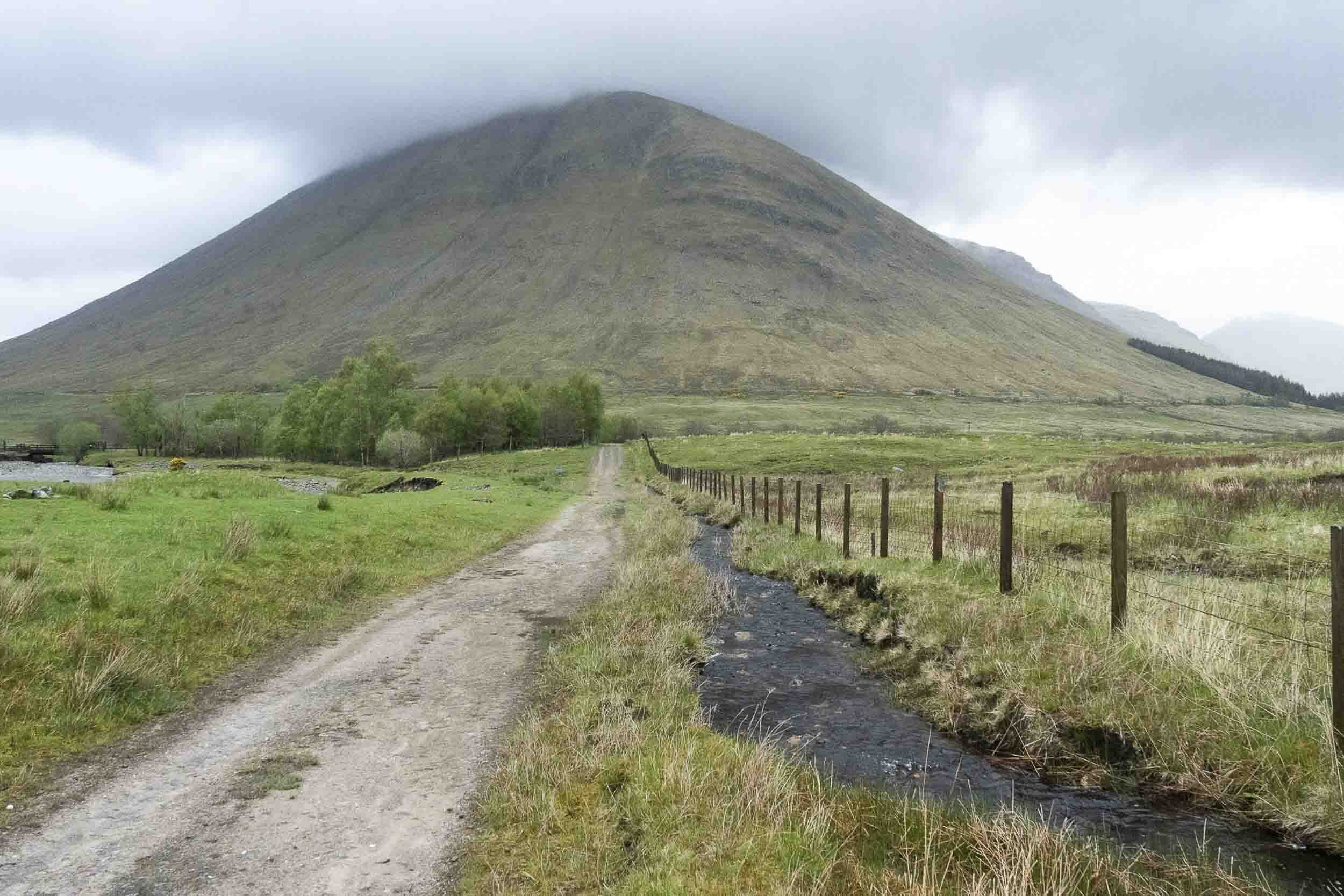
Encountering more mountainous terrain leaving Tyndrum.

About 6.5 miles from Tyndrum is the Bridge of Orchy Hotel, situated next to it is the Bridge of Orchy. If I were to do the hike again (at my age), I would try to stay here to break up the long walk from Tyndrum to Glencoe Ski Center. It was soggy and rainy much of that day.
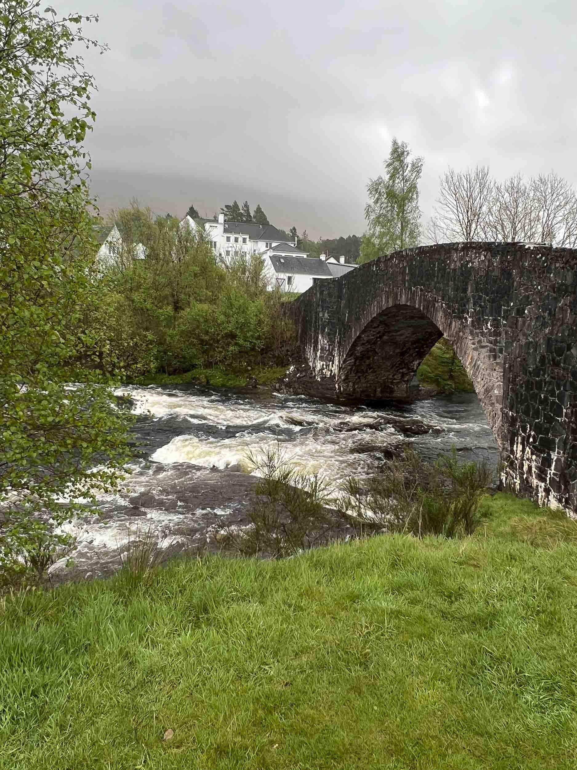
The Bridge of Orchy. It was built to better enable English troops from the south to cross River Orchy and put down the Jacobite uprisings taking place in the highlands. The Jacobites were Scots who wanted to re-establish the Stuarts to the throne, but ultimately they lost. Jacobus was the latin name for James, a Stuart who lost the throne in 1688. There were numerous attempts to recapture the throne but those futile attempts ended in a final defeat in 1746.
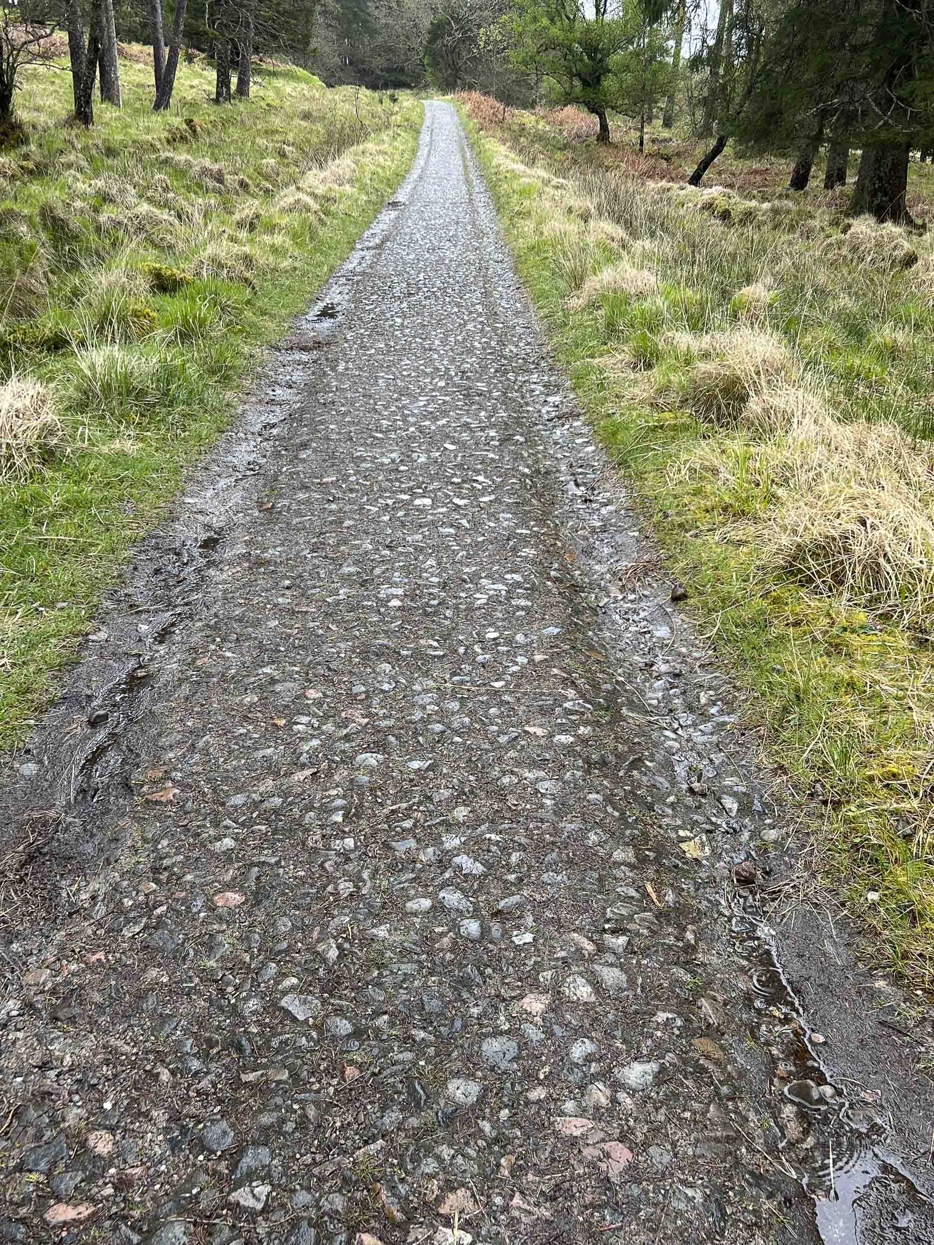
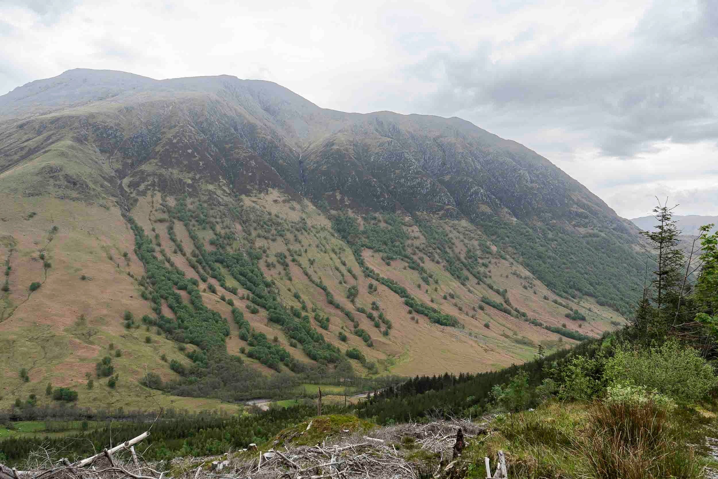
This is the drover’s road, built for transferring cattle over the highlands. It’s uneven and rocky, making it difficult to walk on but offered a solid surface. This is the start of the most remote section of the West Highland Way. I saw no livestock of any kind, nor any wild animals. No fences. No buildings.

This was a location where I had my lunch break. I encountered horizontal rain for much of the day. Luckily the unrelenting and strong wind was to my back, blowing south to north.
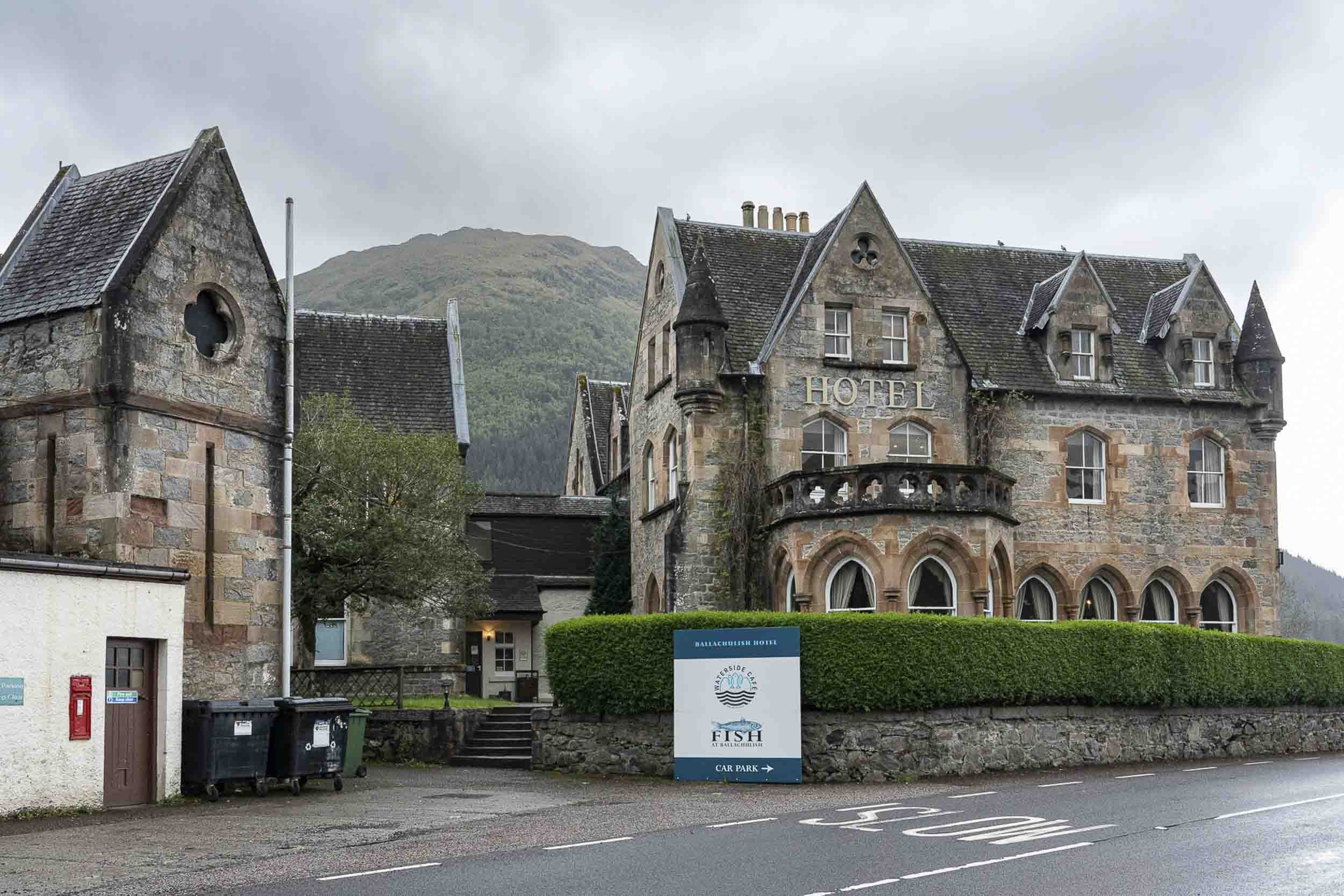
After 19 miles, the trail finally reached the Glenco Ski Center where Macs Adventure arranged for a shuttle van to drive a group of hikers participating in their program to Hotel Ballacullish (built 1877), pictured above.
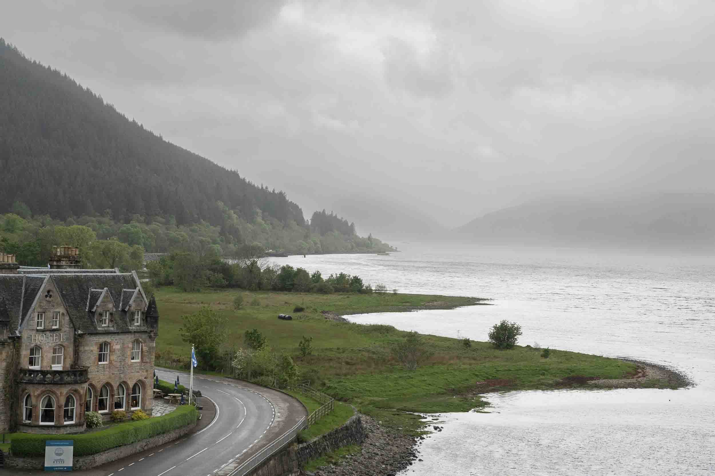
Looking north toward the highlands from the bridge, pictured below.

Looking south by a road next to the Ballacullish Hotel. Before the bridge was built, the hotel was a place for travellers to stay before or after taking a ferry to cross to the other side of the loch. Just to the right, at the top of the stairs to the bridge is a monument to James Stuart who was wrongfully convicted of shooting Collin Campbell in the back while riding with several others near Ballacullish. Campbell was shot in retaliation for implementing the “cleansing” of Stuarts from their territory at Appin (who were considered part of the rebellious Jacobites against the English crown). The jury, consisting mostly of Campbells, found James Stuart guilty of killing Collin Campbell despite Stuart having a solid alibi. Thus, Stuart was hung from a tree by the bridge and his corpse was left to hang there for 18 months as a message to the rest of the Stuart clan and anyone else thinking of rebelling. Nevertheless James Stuart was a leader of the rebellious Jacobites and could have had some input into extracting revenge of the Campbells.
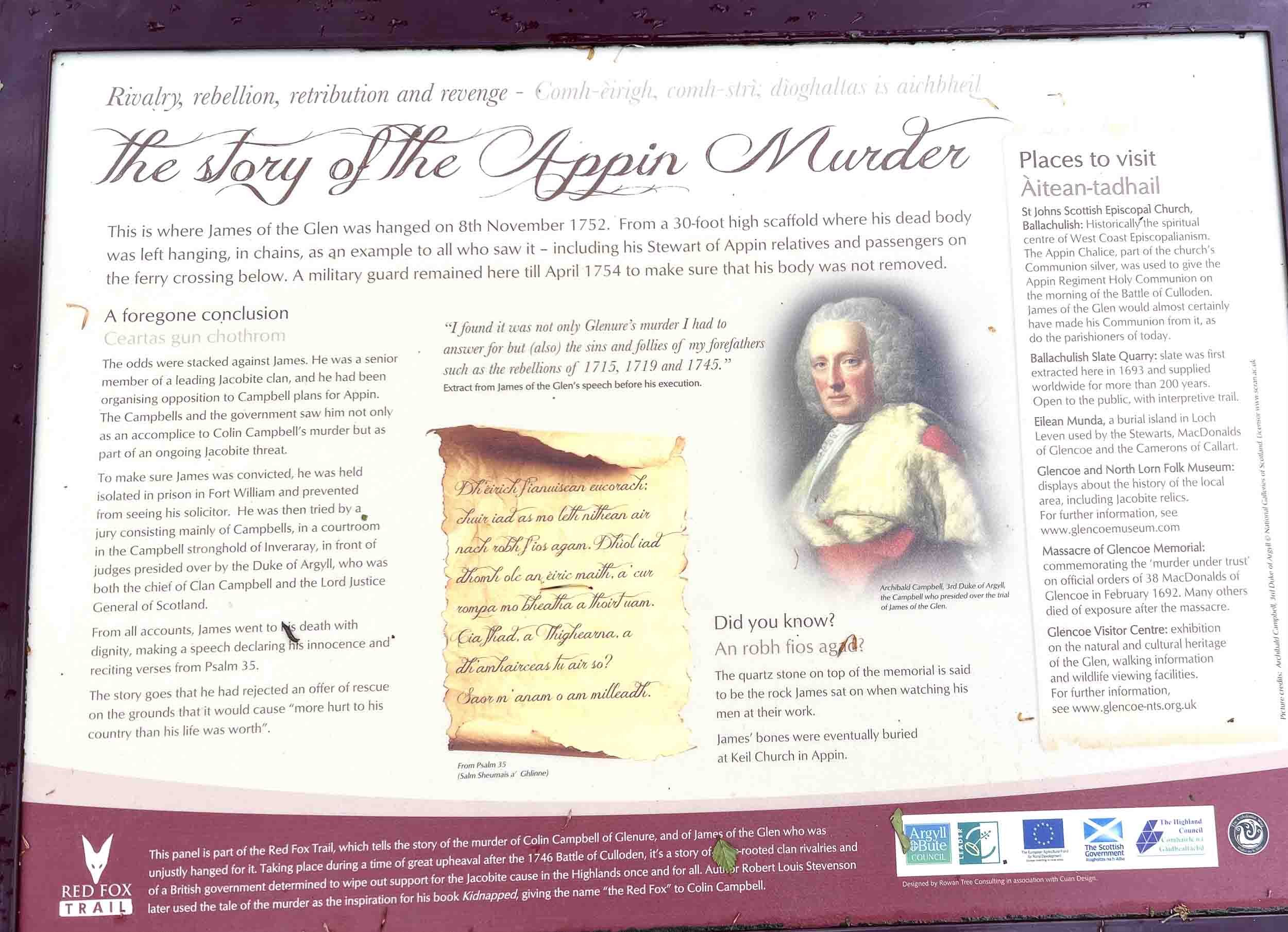

The inscription reads: Erected 1911 to the memory of James Stewart of Acharn, or "James of the Glens", executed on this spot Nov. 8th 1757 for a crime of which he was not guilty.

After being driven back from Ballacullish to the Glencoe Ski Center where we left off the previous day, we started our walk to Kinlochleven.


View of Kinlochleven. The large building used to be an aluminum smelting facility, now an art center. Due to Kinlochleven’s access to water power to create electricity, it was a good location to process aluminum, especially important during WWII.

The Pelton Wheel, invented by Lester Pelton in the 1870s, that allowed the convertion of energy from moving water to energy for generating electricity to smelt aluminum.

My overnight lodging in Kinlochleven. 9 miles from Glencoe Ski Center, a relatively short day compared to previous days.

This is the final day as the trail gets closer to Fort William, the final destination of the West Highland Way. Along the way, a monument to a battle between the McDonalds and the Campbells.

Ben Nevis, just a short ways from Fort William.

The gate that begins the path to climb Ben Nevis, the highest mountain in Scotland (4.413 feet). Climbing Nevis would have required another full day on the itinerary. That was not possible because the next day was for driving to Isle of Skye.

Me,. seated next to the Sore Feet statue in Fort William. The end of the trail, all 96 miles of it.
Statue of Donald Cameron of Locheil, the 24th Chief of Clan Cameron, created in 1909 by William Birnie Rhind and is located in front of MacIntosh Parish Church in Fort William.

Statue dedicated to aluminum smelting factory workers in Fort William.

The sun setting on the shore of Loch Linnhe in Fort William, near Myrtle Bank Guesthouse, my final West Highland Way accommodation.
Myrtle Bank Guesthouse, Fort William.
ISLE OF SKYE
The day after finishing the West Highland Way, my daughters and I drove from Fort William to Portree, where we stayed during our time exploring Skye.

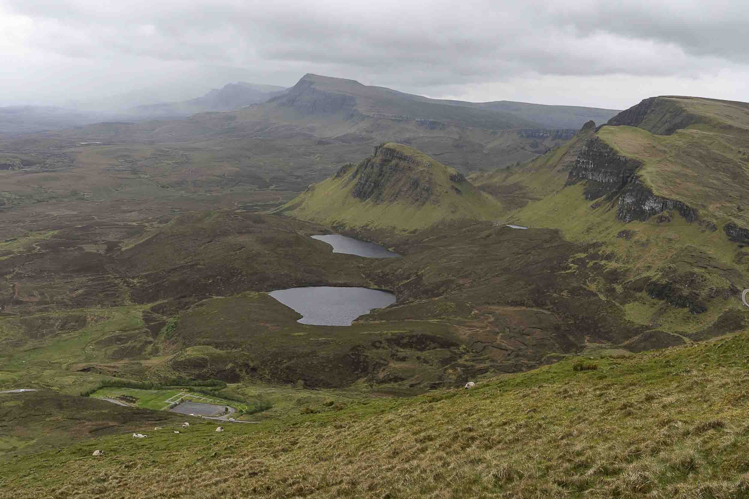
Our first day hike was the Quiraing Loop.


One sheep carcass seems to have been picked clean.


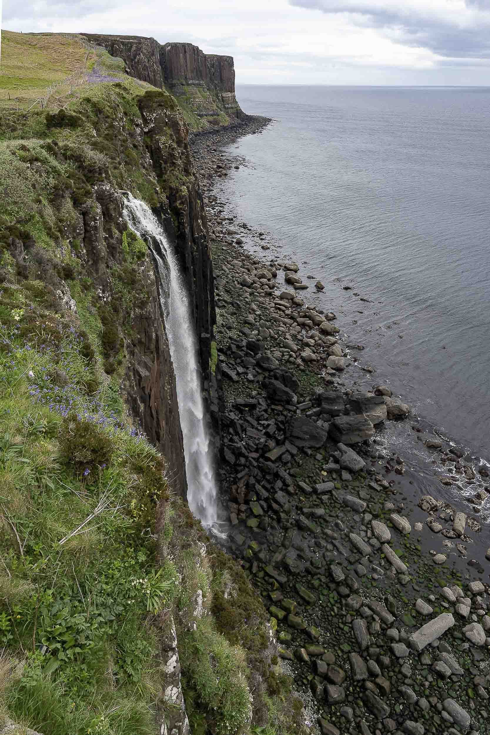
Mealt (kilt) Waterfall.

Partial view of Portree, the largest town on Skye. Population: about 2300.

Attractive plants and home next to the Portree Harbor.

Cruise ship in Portree Harbor. Nearby are a series of salmon pens.

The path to and from the Fairy Pools, a series of small pools of crystal clear but cold water that flow down fromthe Black Cuillin range in the far background. Some people make a point of coming to pools to bathe (briefly!) in the frigid water.

Clear water.

Statues of two early, renowned explorers of the Cuillin mountains on Skye, John Mackenzie and Professor Norman Collie. Their statues are located next to the Sligaghan settlement and bridge.
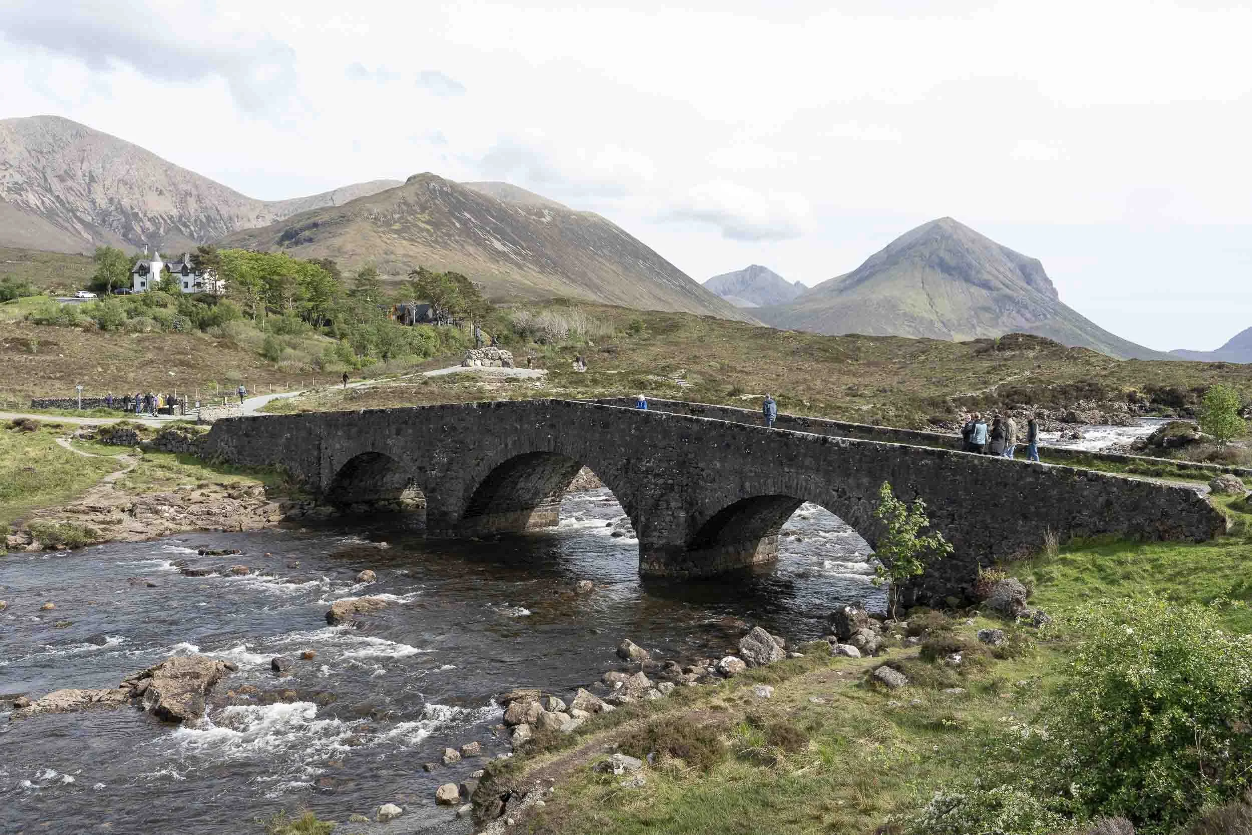
Sligaghan Old Bridge, built 1810 - 1816.

Fairy Glen, not to be confused with the Fairy Pools—separate llocations and distinctly different.
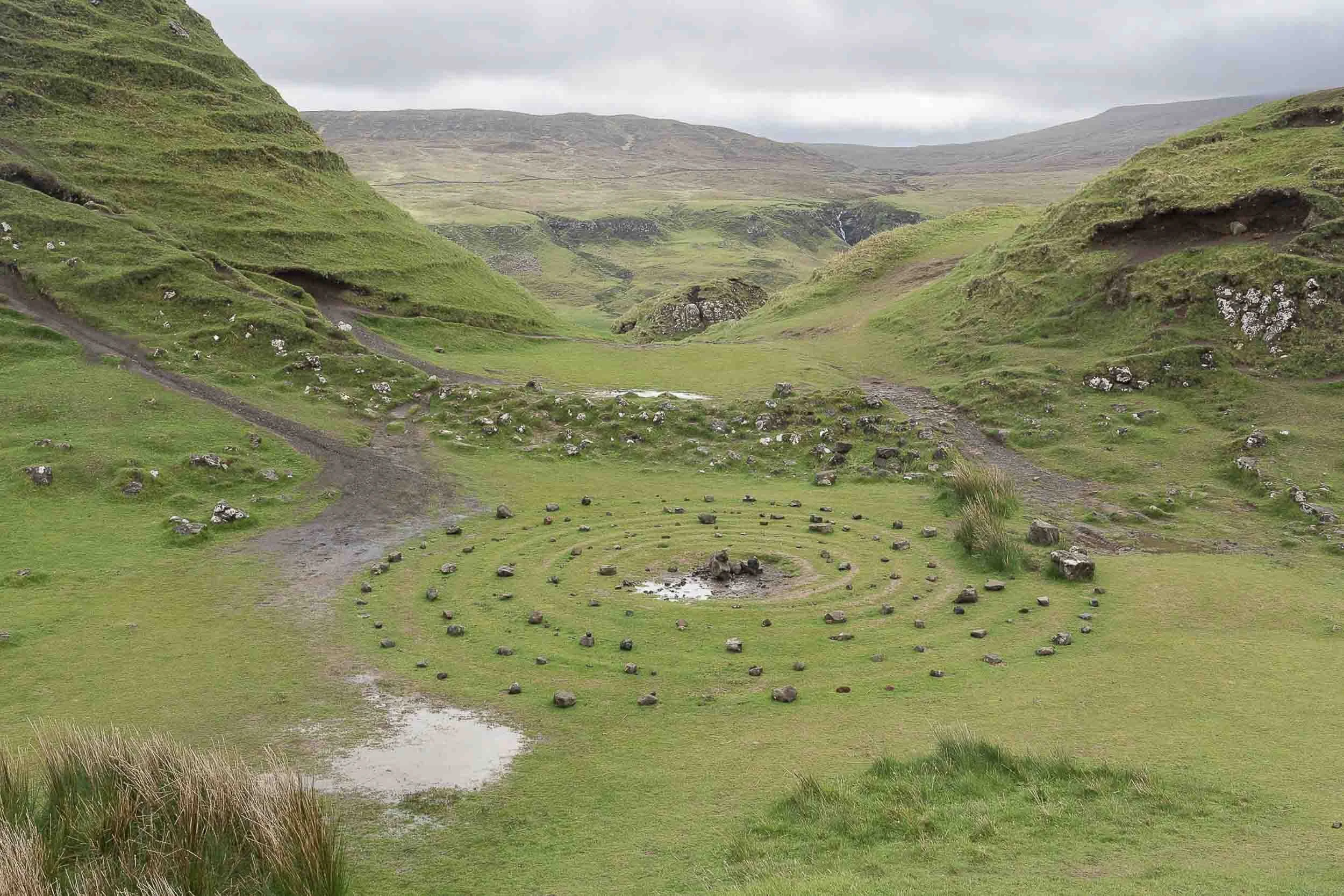
The Fairy Glen.


Old Man Storr

Formations next to Old Man Storr. It was very wet, rainy, and cold that day.

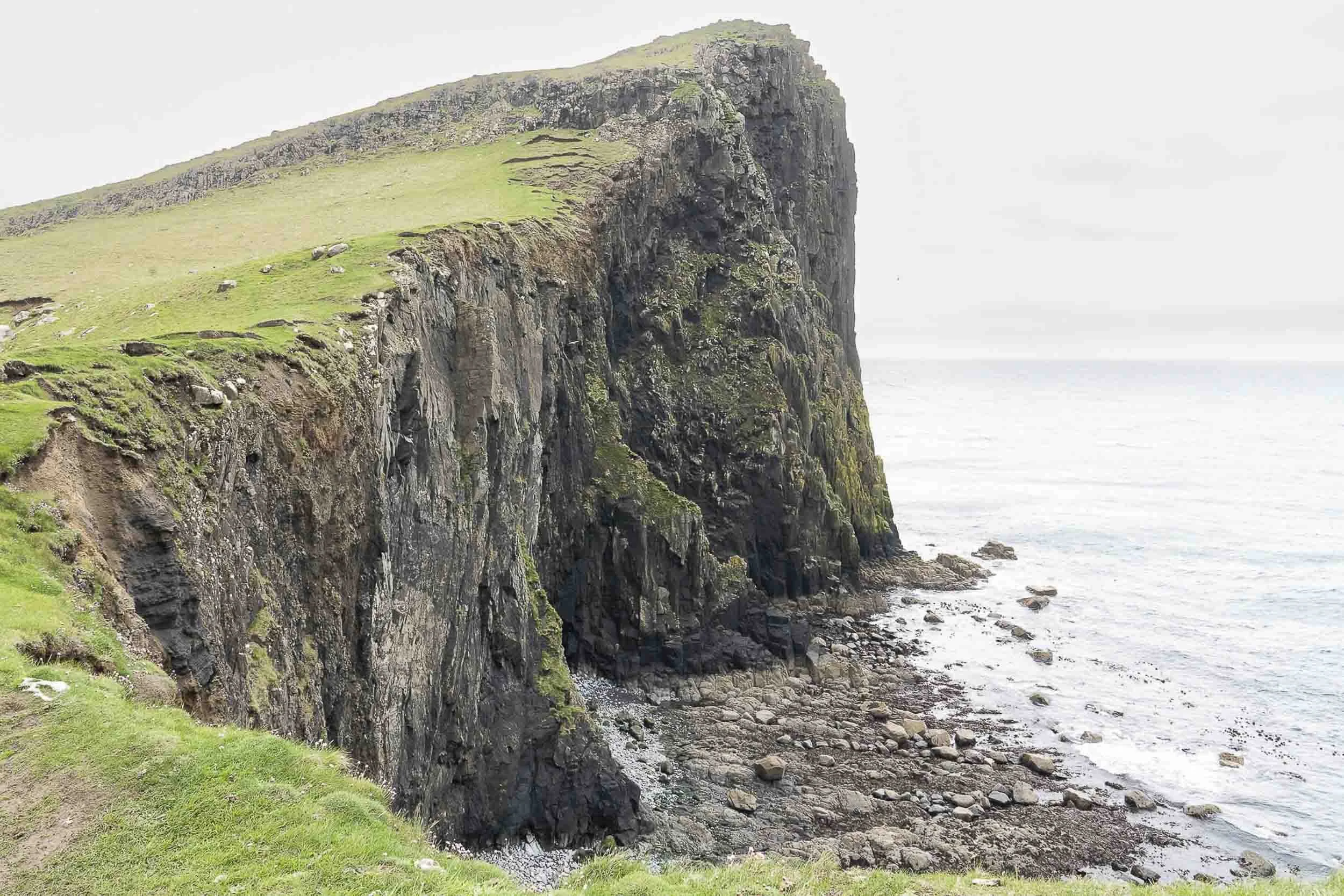
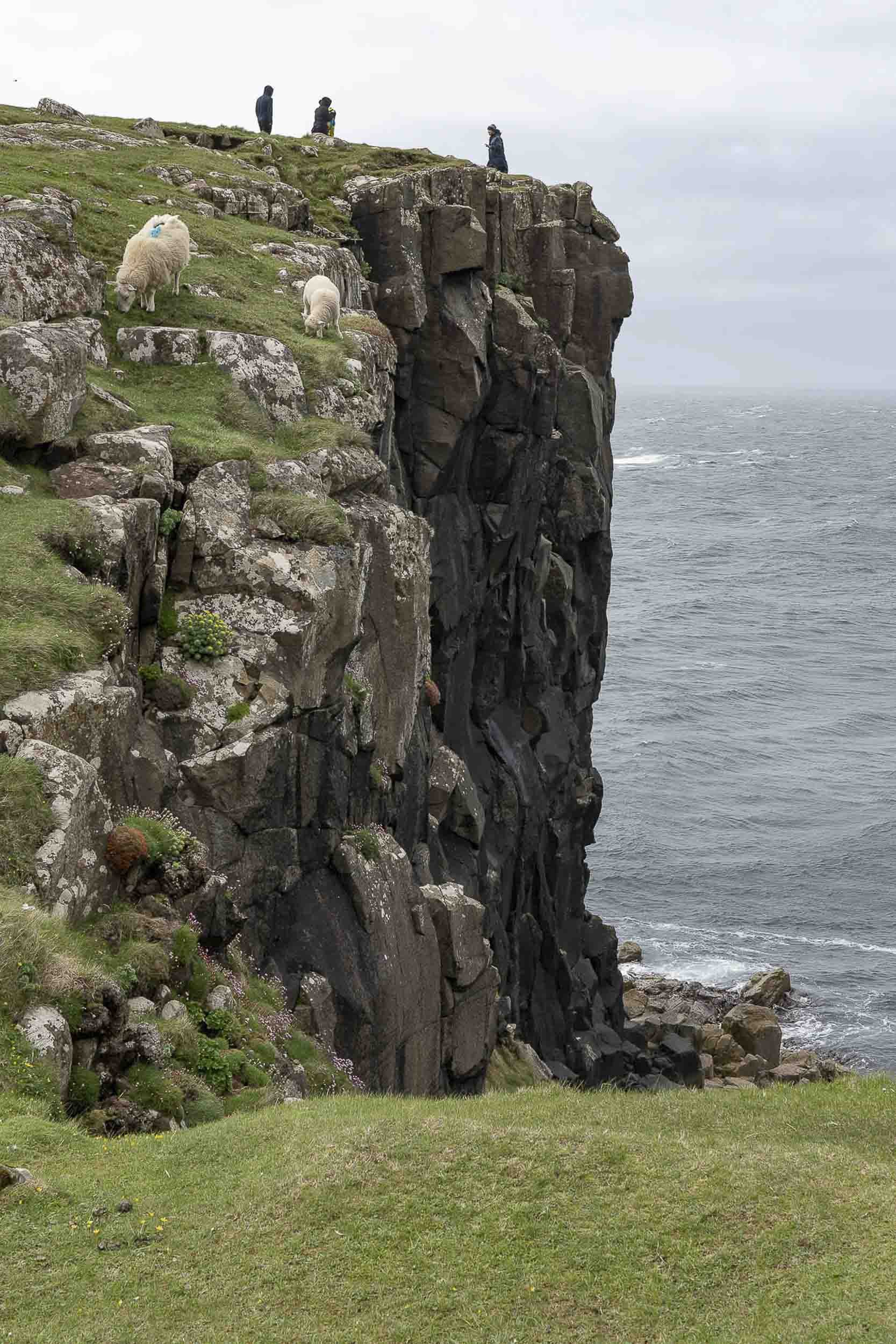
A visit to Neist Point on the west side of Skye, jutting out into the Atlantic. The lighthouse, further below, is still operational but the “keeper’s house” is now in private hands.


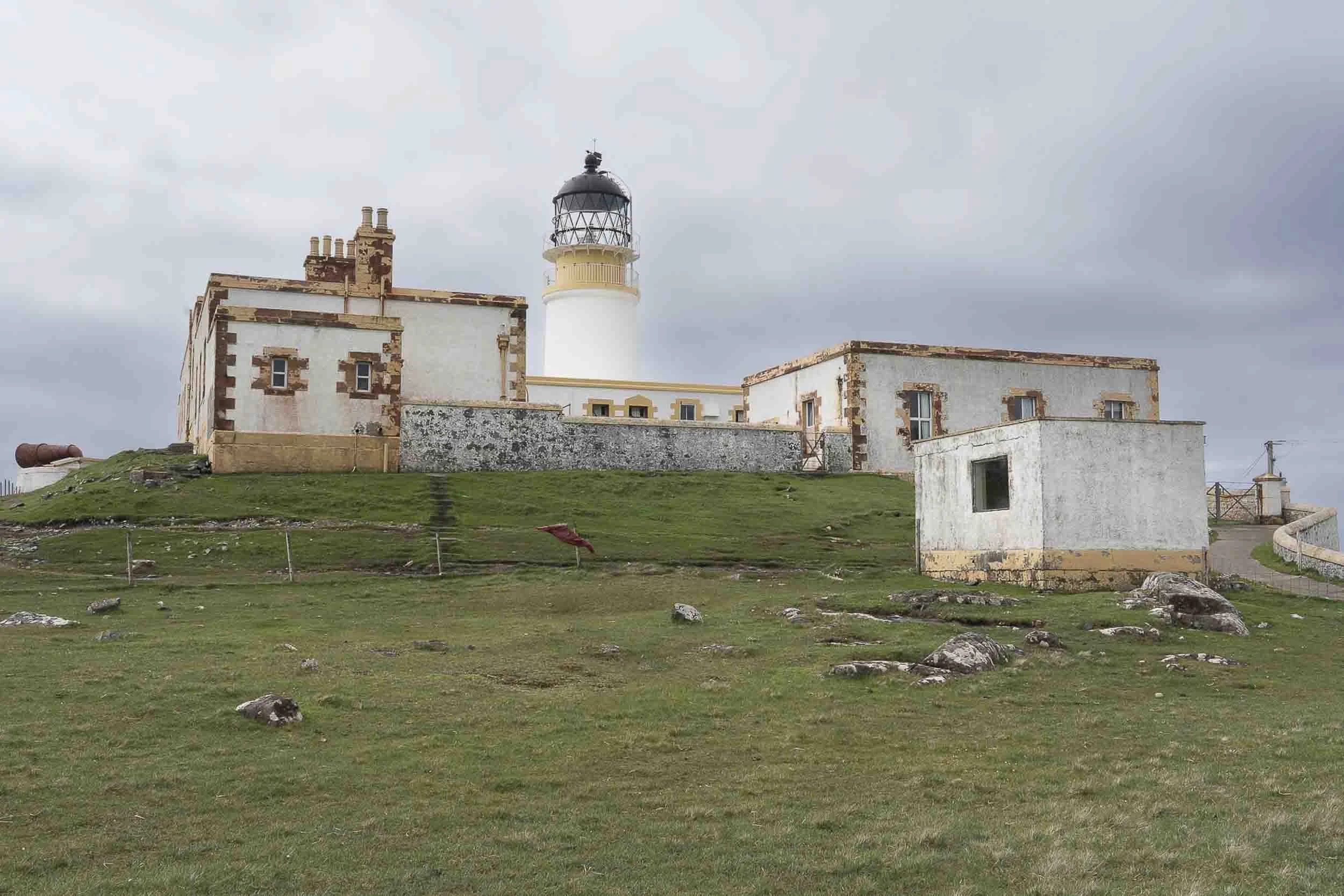
Neist Point Lighthouse, operation in 1909. Today, it is controlled and operated by remote.


One final view of a Scottish castle, the Eilean Donan Castle, before heading back to the US.