Following my hike to Switzerland in 2022 (further down the page), I visited the country again in 2023, this time with my wife. These photos immediately following are from day hikes and visits to the historic sections of Thun, Bern, and Lucerne.
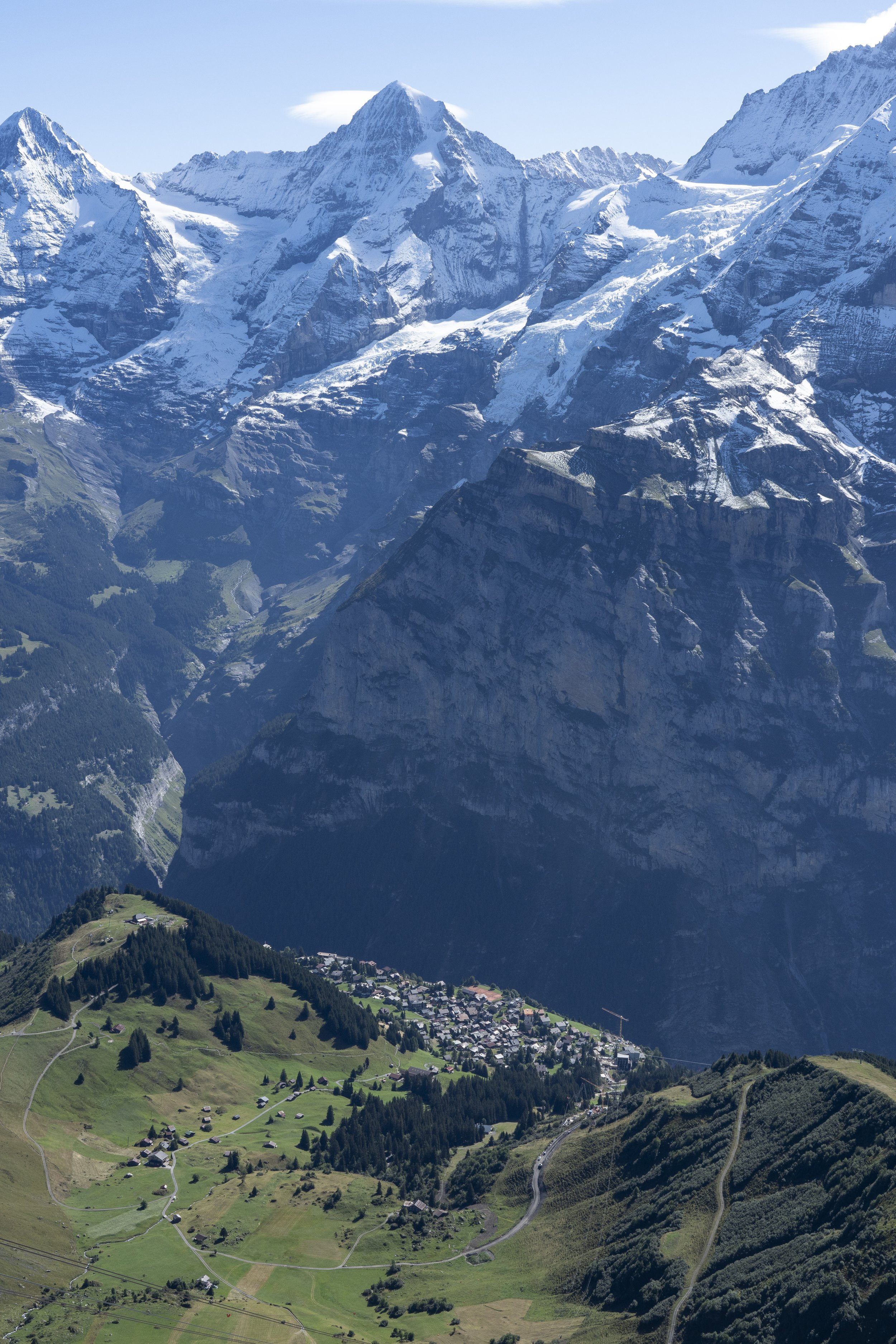
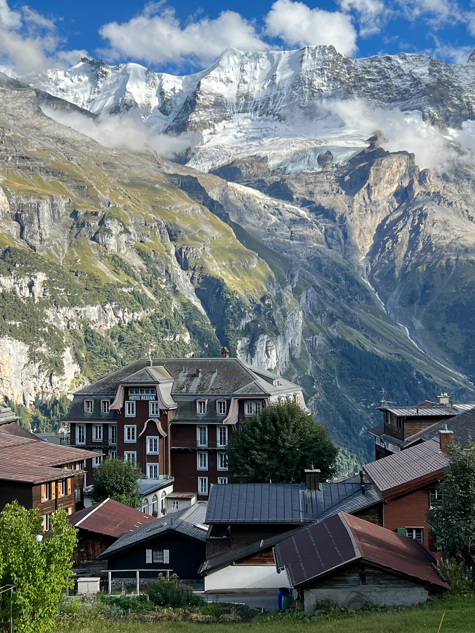
Before visiting the historic cities, we headed to the Bernese Oberland Alps. Wengen was our anchor location for our stay because it was situated between Grindelwald and Mürren. On August 28, the day of our arrival, we were greeted with rain. However, in the higher elevations of the surrounding mountains, it snowed. So a number of photos from our day hikes in the area included a fresh coat of snow.

Alpine Lake Bachalpsee is a relatively easy walk from First (pronounced Feerst) by taking a gondola from Grindelwald. The cows, usually still grazing in the alpine area in early September, headed for lower elevations to avoid the snow and cold weather.

Mannilichen, reachable by cable car from Wengen, is the start of a pleasant, slightly downhill hike to Kleine Scheidegg.

Kleine Scheidegg can be seen on the trail coming from Mannilichen. Kleine Scheidegg is our destination for taking the cog rail up to the Jungfraujoch.

Hikers, standing above the Kleine Scheidegg area, are taking photos of the distant structure that’s situated in the saddle (the Jungfraujoch) between the two peaks, the Mönch (left) and Jungfrau (right).

The view from the Jungfraujoch observation deck (11,362 feet above sea level) of people snow tubing down the ringed shute.

Above, on the right, are three mountaineers descending the Mönch.

Back in Wengen, the view of the Lauterbrunnen Valley.

View of Mürren from the cable car to Schilthorn
Another view of Mürren further up the cable car ride to Schilthorn

“Main” street in Mürren (which banished cars from its streets—only the occasional service vehicle drives the narrow streets).

Trail at Schynige Platte (accessible by cog rail) with a small portion of Lake Brienz viewable on upper left.

A couple resting after some hiking, taking in the views of Schynige Platte, and a small rock cairn on the right.
Thun
The city of Thun (toon) has a very long history that goes back thousands of years. It is located by Lake Thun on the Aare River. The highlight of the old town is Castle Thun and the area around the city square.
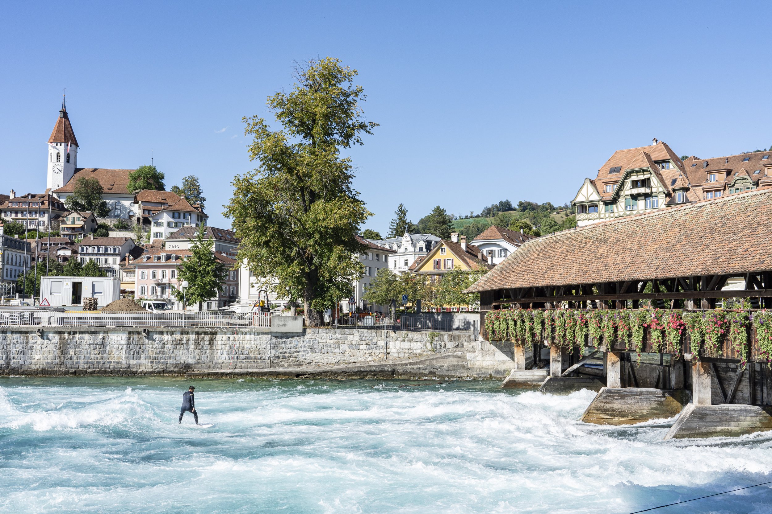
This gentleman is surfing on the river Aare as water is released from the gates under the wooden bridge that hold back Lake Thun. Generally, the surfers hang on to a rope tied to the bridge to hold them in place against the fast current but the rope is not visible in this photo, so I’m uncertain if he dropped the rope at the instant I took the photo. He is wearing a wetsuit as the water in Lake Thun can be cold.

The Stadtkirche Thun (reformed church) in the background with the clock on its steeple, dates to about 1330.
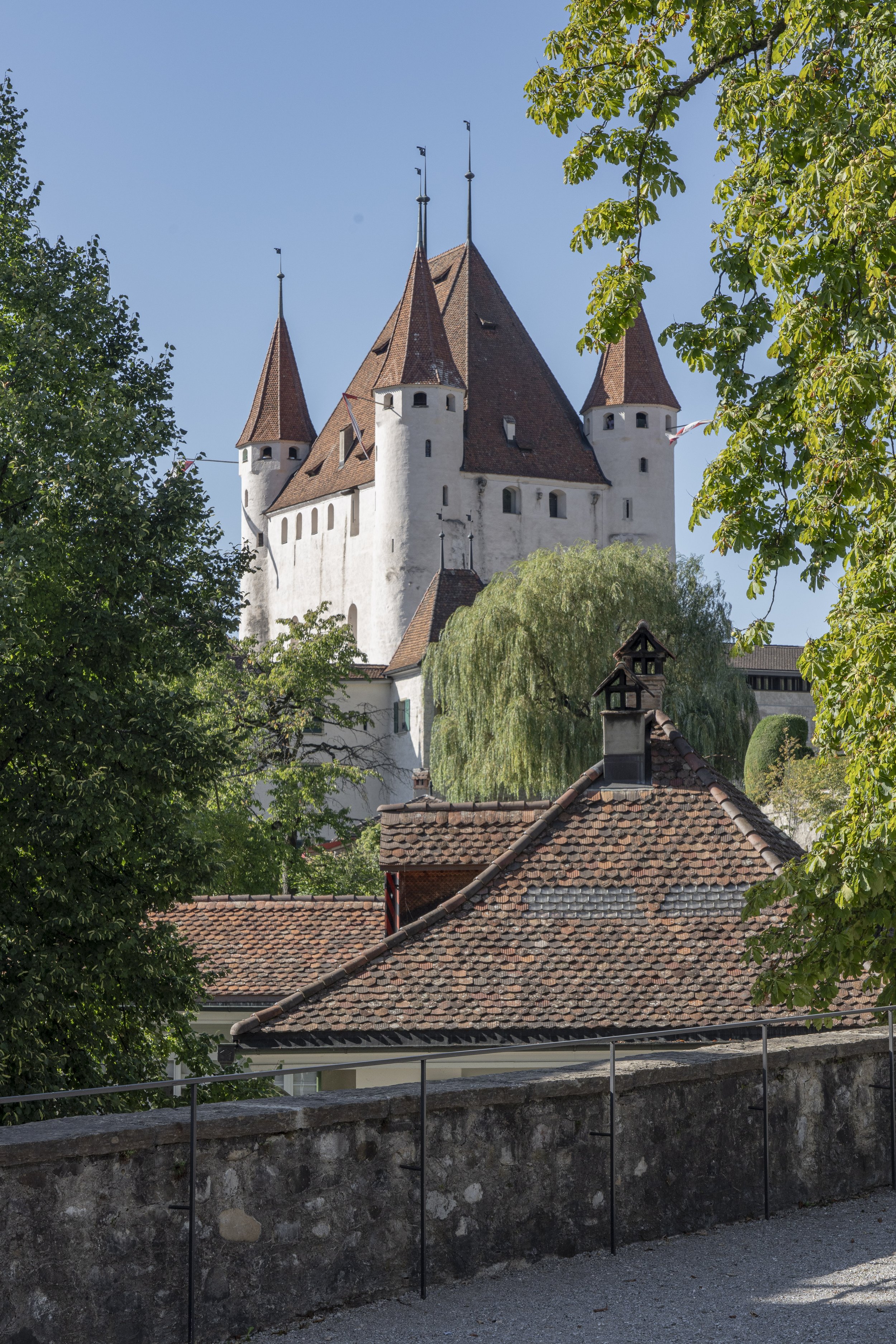
Approaching Castle Thun, built in the late 12th Century.
Bern
Bern is the capital of Switzerland, established in 1191 by Berthold V, Duke of Zähringen. Berthold gave the name Bern after the first animal he encountered on a hunt in the area, which was a bear. An image of a bear is on the city’s coat of arms and the city has housed captive bears since 1513. Today, the bears reside in BärenPark/Bear Park. Bern is also where Albert Einstein lived from 1903-05 and developed his Theory of Relativity. The old part the city, the Aldstadt, fortunately has been preserved and was not bombed during WWII owing to Switzerland’s position of neutrality.

View of the Altstadt.

Paddleboarder just chillin’ going down the Aare River on a Sunday afternoon.

The Zytglogge (literally time bell, or clock tower). The tower was built 1218–1220 originally as a prison, but was burned in a fire in 1405. The clock, bell and astronomical clock was installed shortly after the fire when rebuilding the tower. The gilded bell ringer (introduced in 1530) moves each hour to strike the bell.

The rooster crows just before the bell rings to announce the hourly chiming of the bell. The jester, above, jokes that the rooster is too early. A parade of bears circle around underneath the seated timekeeper (Chronos, the god of time) with an hourglass in his hand, which he turns over on the hour.
Lucerne

The Kapellbrücke (Chapel Bridge)—a wooden footbridge over the Reuss River—was originally built in 1360. Under the roof are triangular 17th century paintings depicting Lucerne’s history. The church in the background on the left with the twin steeples is the Hofkirche (Catholic), built 1633-1639, after a fire destroyed the original structure. Its original foundation dates back to 735.

Above, a sample from a series of triangular paintings about the plague, hung under the roof of the
Spreuerbrücke (Spreuer Bridge), another nearby footbridge over the Reuss River in Lucerne.

Near Lucerne is Mt. Pilatus, accessible by cable car, which offers a wonderful view of the area on a clear day.

On the left is an opening of a tunnel that allows visitors to view the surrounding flatland below Mt. Pilatus.

View of Lake Lucerne from Mt. Pilatus.

Not everyone who dines at Mt. Pilatus pays for their food.
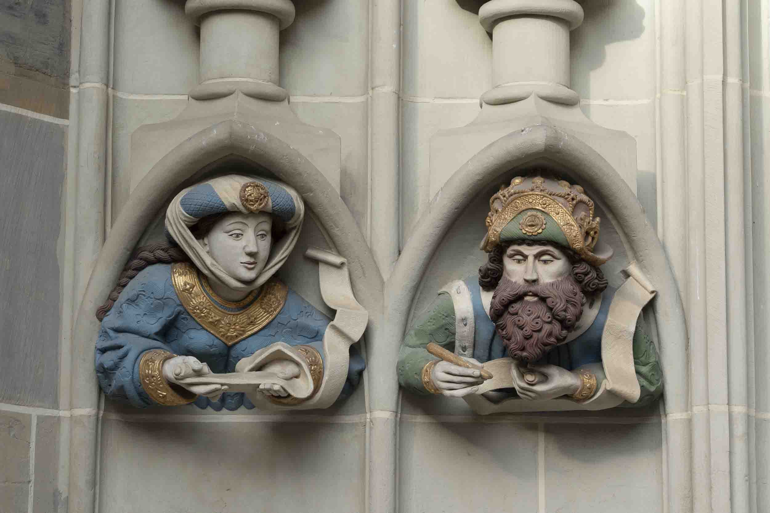
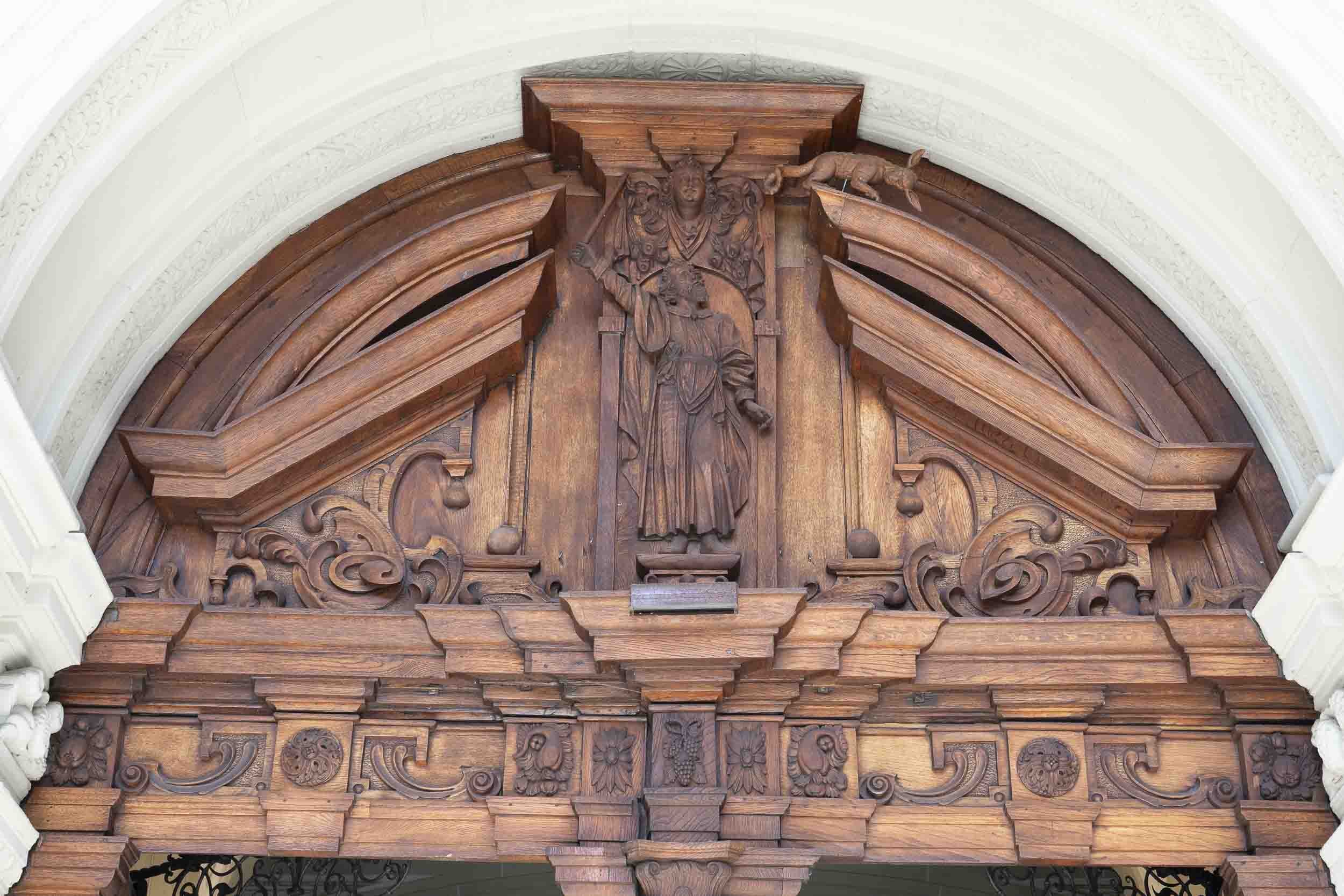
This section has several images of artisan work that caught my eye while roaming the streets of the cities we visited.


In September 2022, I hiked in Switzerland from Grindelwald to Wengen, Mürren, Griesalp, Kandersteg, and Leukerbad. After the hike, I visited Zermatt and Zurich. These images are from that trip.
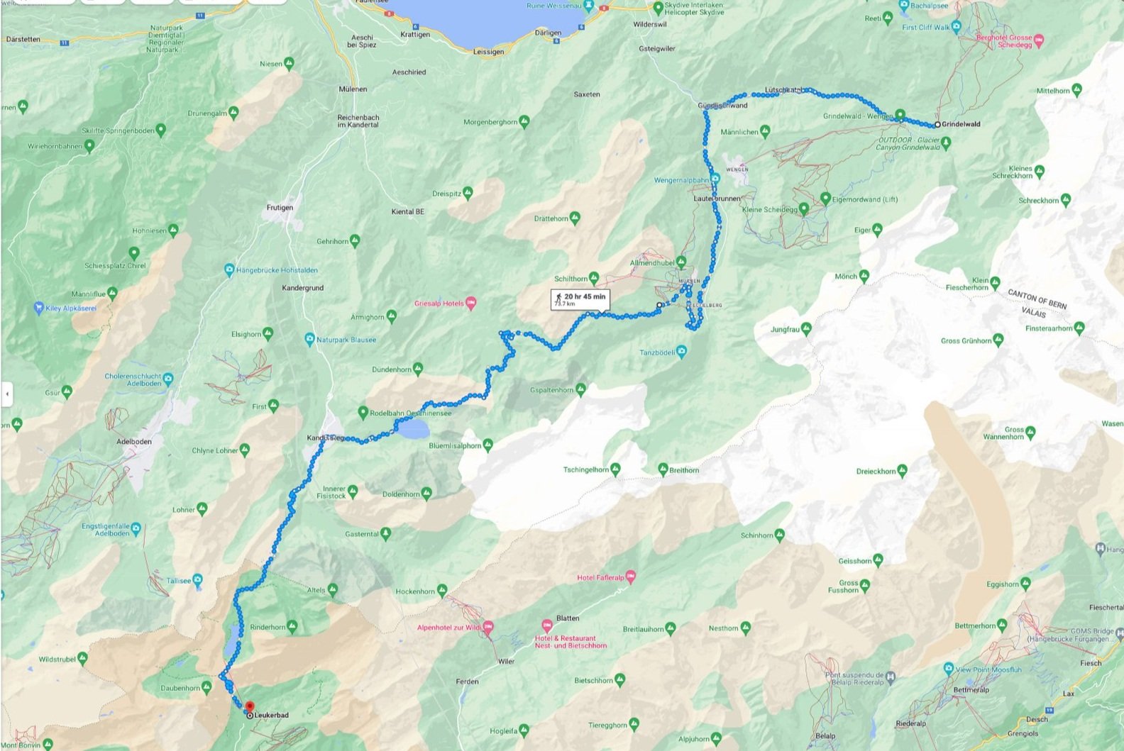
The map below shows only a general approximation of the walk from Grindelwald to Leukerbad because it does not recognize all the parts of the trail. It also does not include Zermatt or Zurich.


Grindelwald


After landing at Zurich and taking the train to Grindelwald, I walked around the town during the remaining hours of Swiss sunlight. The photo of the church shows the Eiger mountain in the background. The Eiger is notorious for climbing deaths.
I was impressed by the care of the graves in the cemetery adjacent to the Reformed Church. It (and cemeteries I saw in other towns) shows the respect the Swiss have for their ancestors.
I allowed myself a full day to acclimate to the change in elevation from Brooklyn, NY. On that day, I took a cable car to First and then walked the graveled path to Lake Bachalpsee. The walk was through pasture land so there were many cows roaming about with their neck bells clanging as they forage on the landscape. The lake is a popular destination for many, including older adults, since the trail is not a strenuous walk. Before returning to the cable car to go back down to Grindelwald, I walked the First Cliff Walk and lunched at the Berggasthaus Restaurant. It offers great views of Grindelwald and the valley below. Paragliders were also busily floating about in the air.
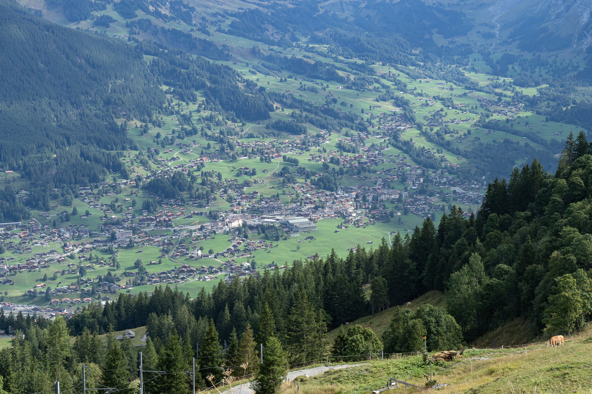
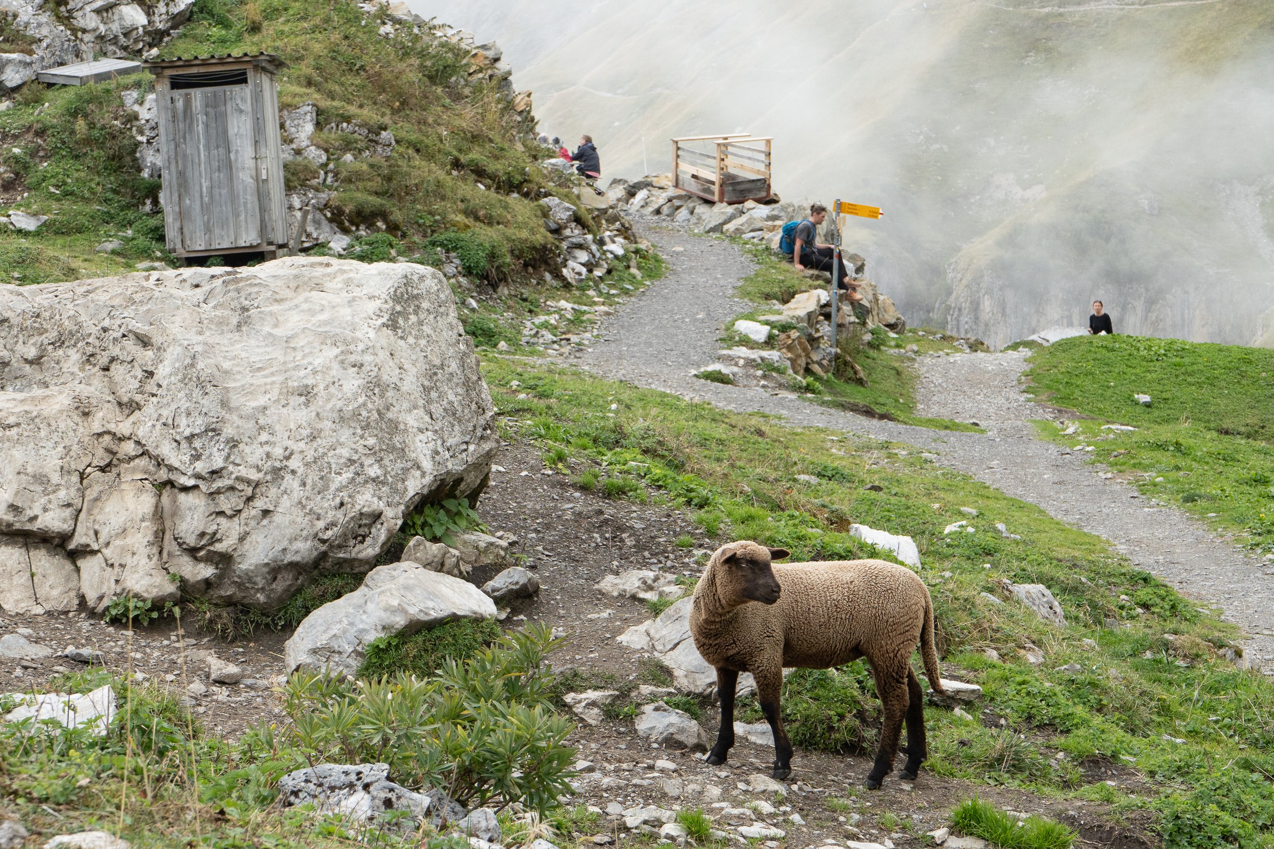
The first full day of hiking was walking from Grindelwald to Wengen. The hike was up the opposite side of the valley from the previous day‘s visit to First. That is why Gindelwald is an appealing destination. It offers destinations on both sides of the valley in which it resides, plus the great scenery of the surrounding mountains. The hike to Kleine Scheidegg was part of the Via Alpina One trail that crosses Switzerland east to west. Trail systems are noted with small green patches on the signposts.
The trail to Wengen rises up out of the valley and travels near the cog rail to Kleine Scheidegg, the name for the mountain pass (6700+ feet in elevation) between the two towns. The tram from Grund (also a train stop in Grindelwald) to Kleine Scheidegg is visible from the trail. There is a train station and lodging located at the pass with great views. There are also stops on the way toward the pass that allow passengers to get off and walk back to Grindelwald, which is what an elderly couple did, as seen in one of the photos below. At Kleine Scheidegg, I had rosti (see photo of large cast iron wok-shaped pan), a popular Swiss dish comparable to hash browns in the US. The trail signs are given in time rather than distance. In the German areas, the signs maybe marked with Std, an abbreviation for the German word Stunden, which means hours. So 6 Std 10 min means to expect to walk 6 hours and 10 minutes to the destination. That does not include time for stops. One has to add additional time for that. The trail is very well marked. I hardly used my maps. Yellow signs are for hiking. Red signs with bike emblems are for mountain bikes.


Grindelwald to Wengen
Wengen


The following images are taken while hiking the trail from Wengen to Mürren.
Mürren

Wooden bridges had carpeting so as not to slip on the boards when wet. Very thoughtful of those who maintain this part of the trail. That didn’t make it any less steep, though!
From Mürren, the view across the Lauterbrunnen Valley is a wall of impressive snow-capped mountains. I saw the most acrobatic displays of paragliding at Mürren. The wind in the valley was relatively quiet, lending itself to the sport. I did not have time to explore, but one of the big features of visiting Mürren is the tram that travels up to the Schilthorn, a lookout perched high on a mountain top that has a rotating restaurant.

Mürren to Griesalp


Below is a view of Mürren as I headed up the steep trail toward Sefinenfurgge Pass. A ways up from Mürren is Rotstockhütte, a good place to stop for a snack before tackling the Pass. Once at the Pass, the trail descends to Griesalp and several other nearby backcountry hotels. The hotels are not in any way primitive. My dinner at Griesalp was delicious. I say backcountry because there is no town at Griesalp.


Griesalp to Kandersteg
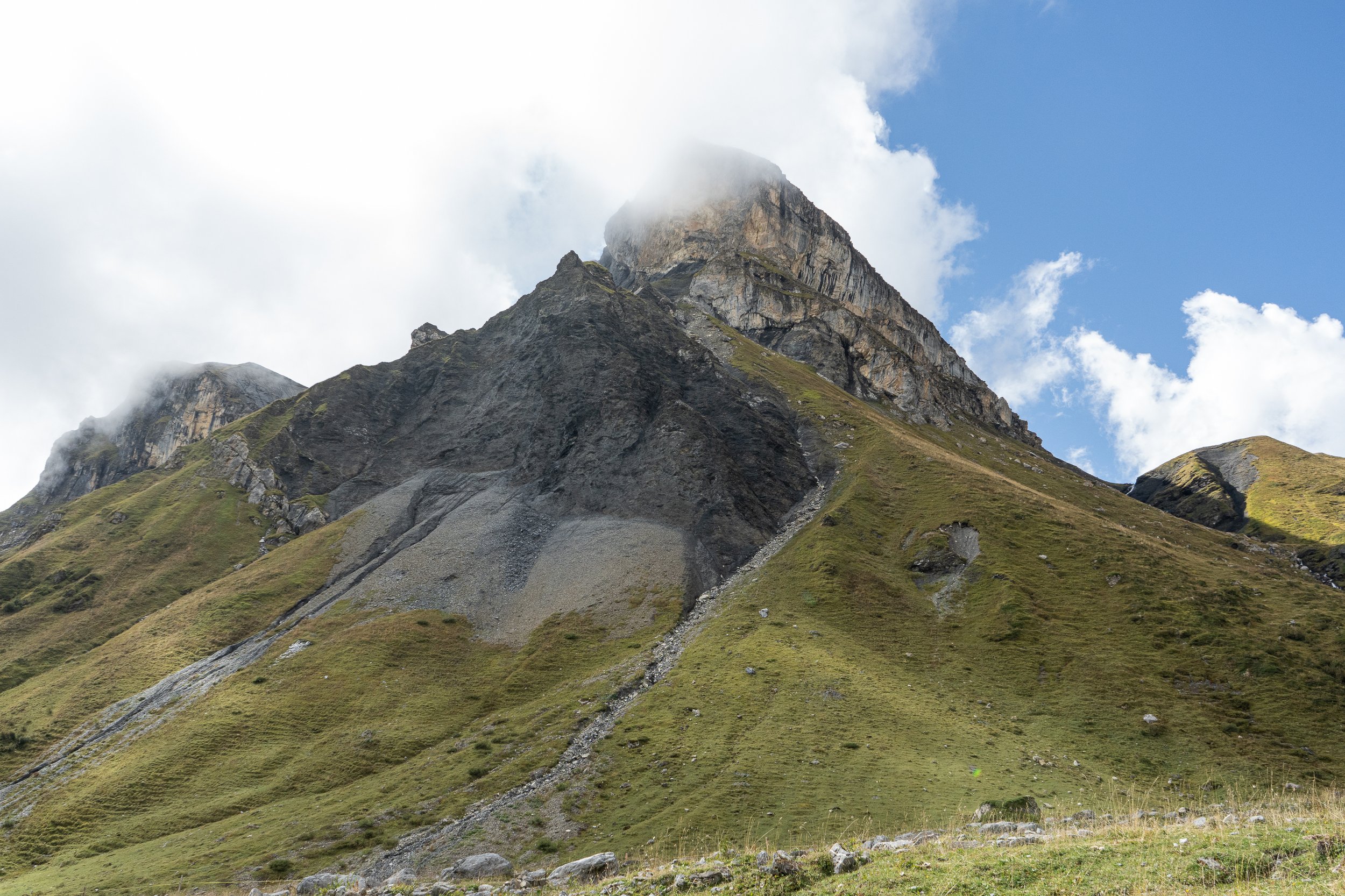
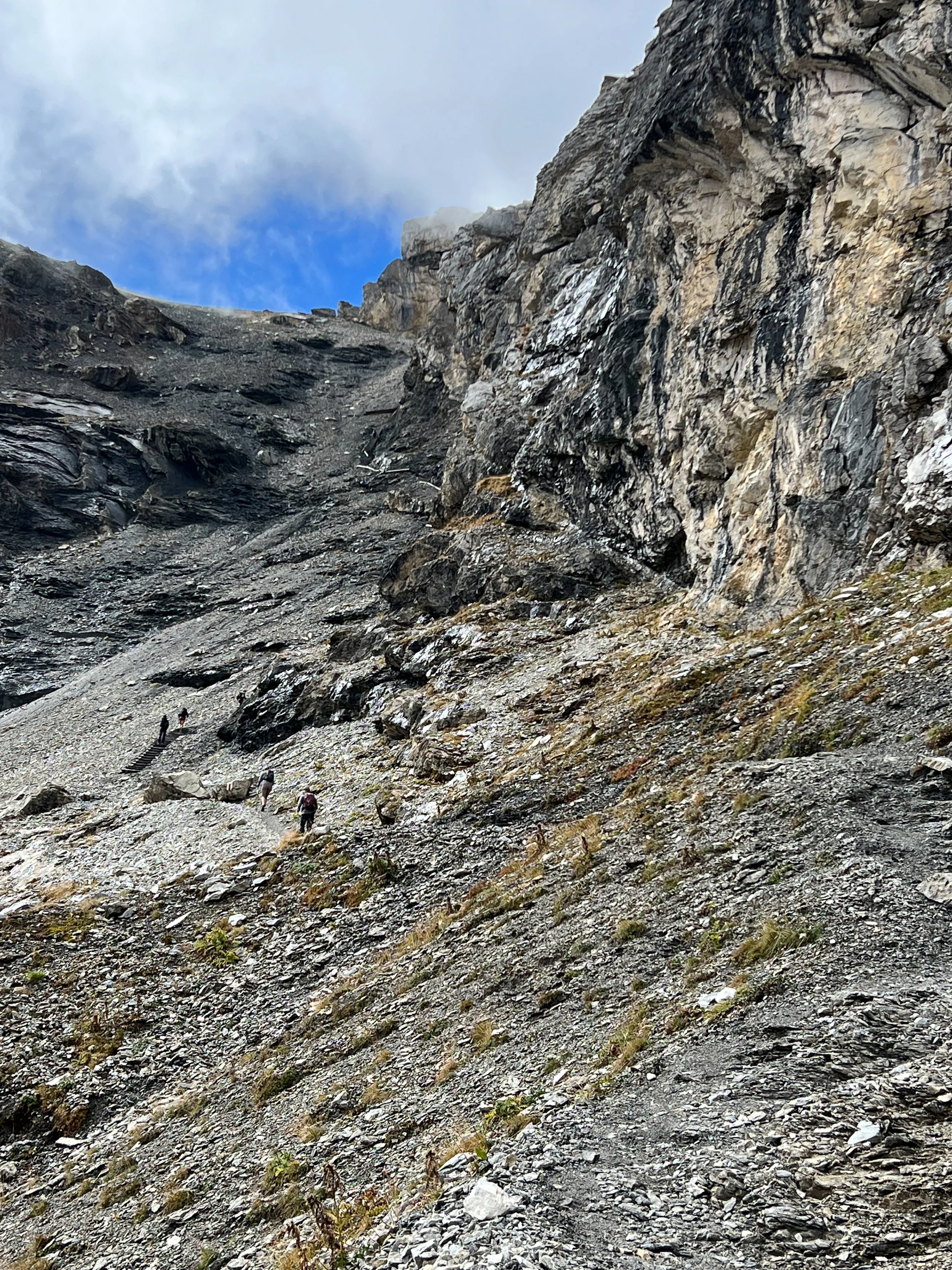
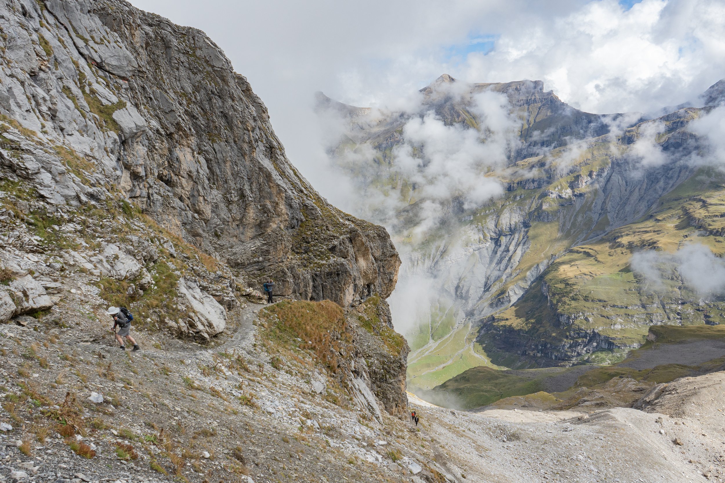
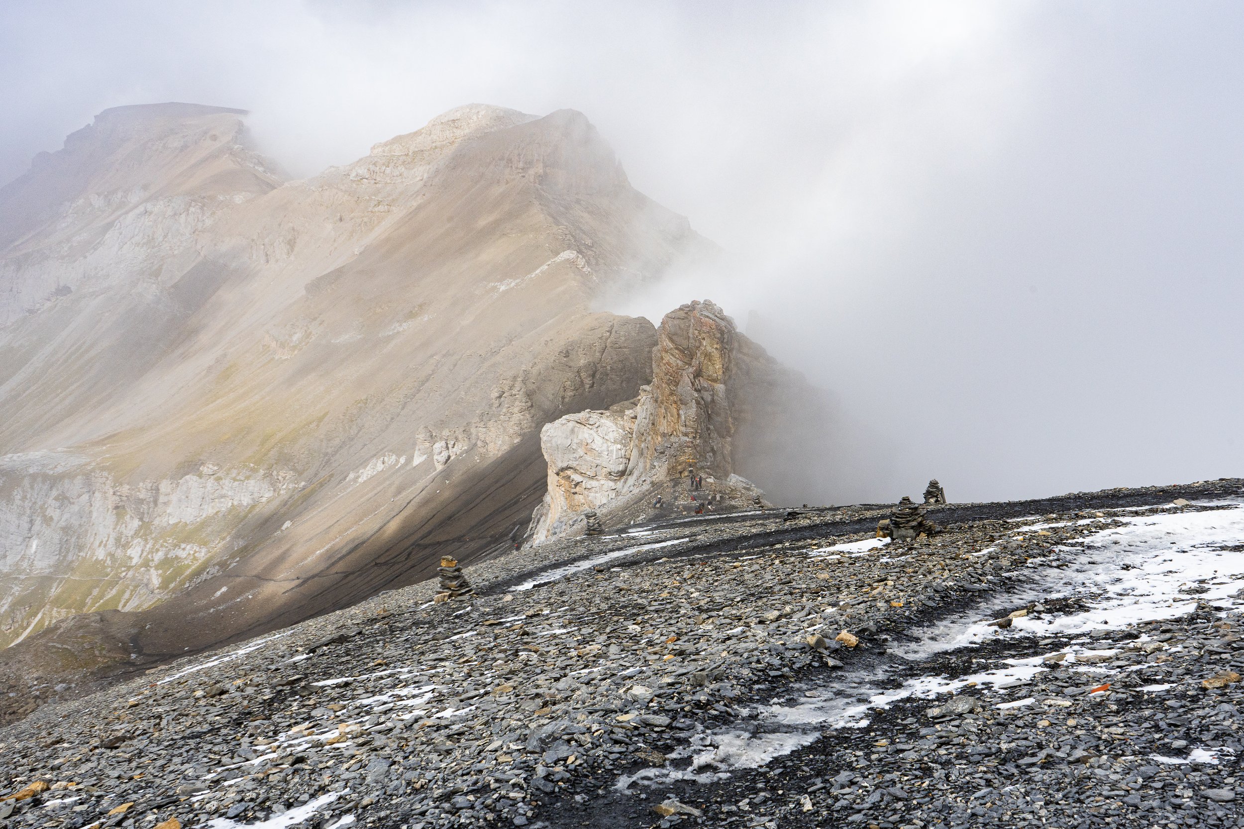
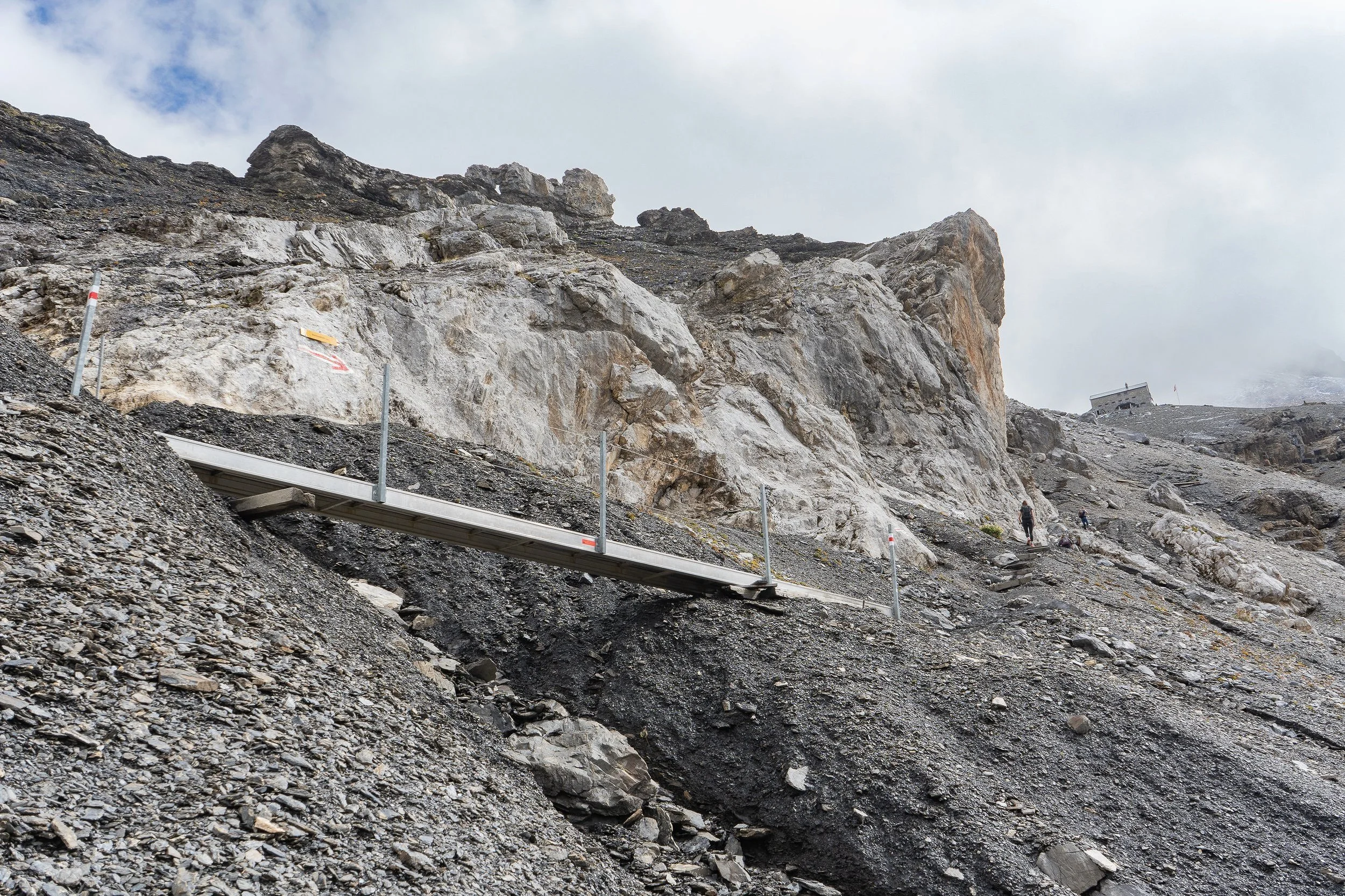
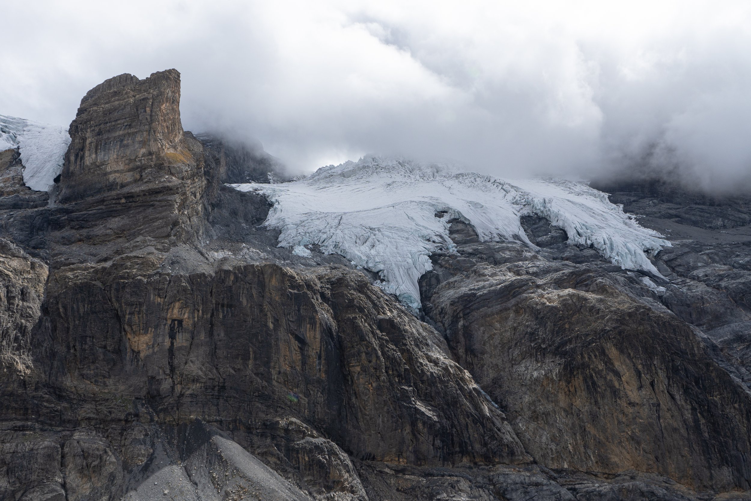
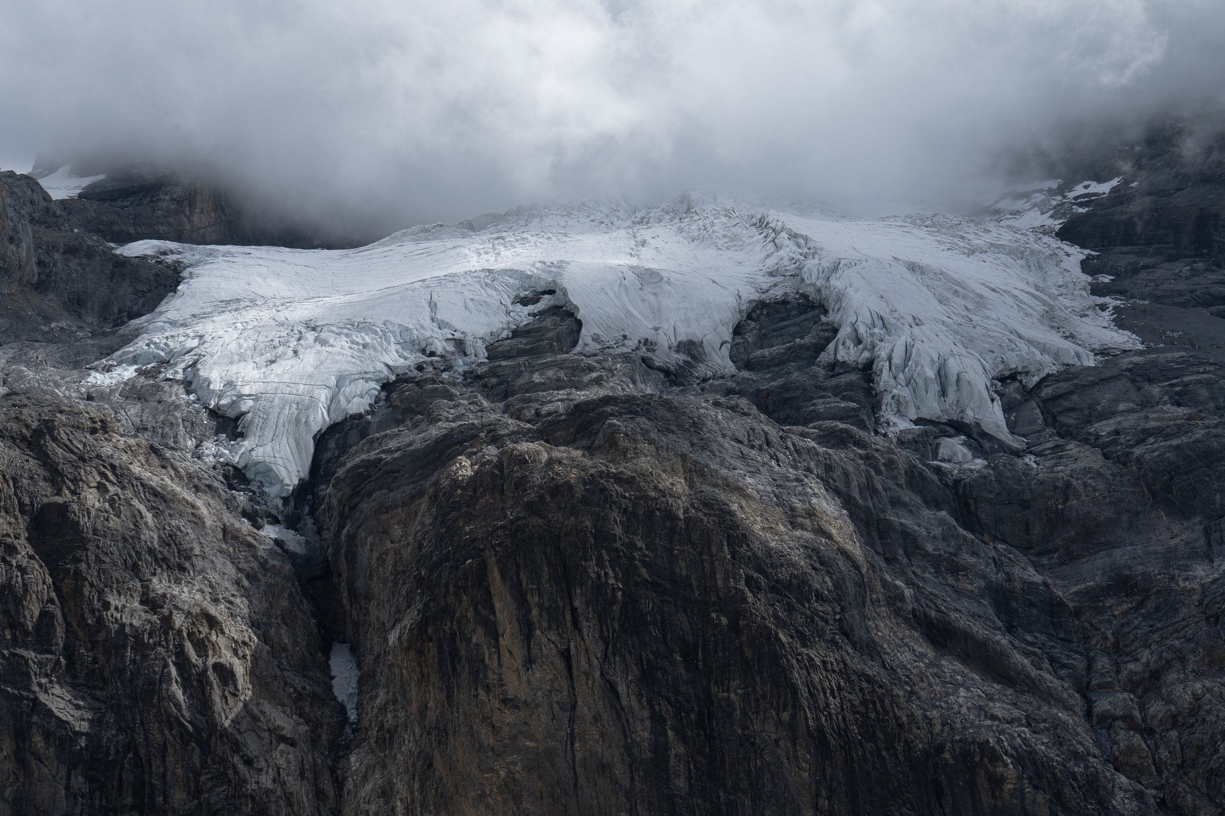
The Alpina One trail leaves Griesalp and climbs steadily past the Berghaus Bundalp lodging/farm and continues an even steeper climb to Hohturli Pass (approx. 9,100+ feet above sea level). As the trail reaches the Pass, the trail becomes a long series of stairways consisting of wooden steps notched between two long logs that are embedded in the scree to prevent them from drifting downhill. The trail also hugs the base of cliffs on both sides of the Pass for the same reason. At the top of the pass is the Bluemlisalp Hut where food and lodging are available.
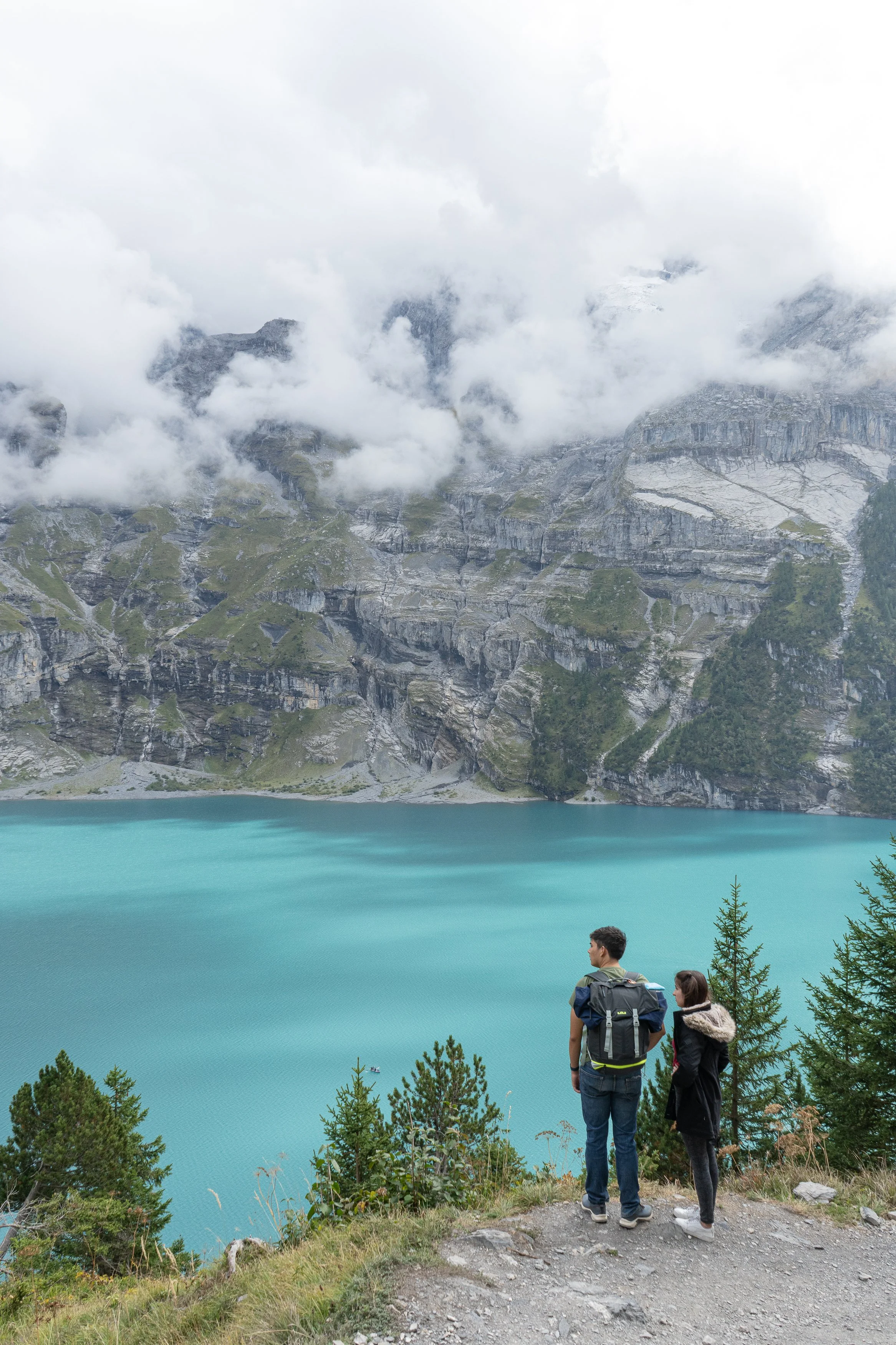
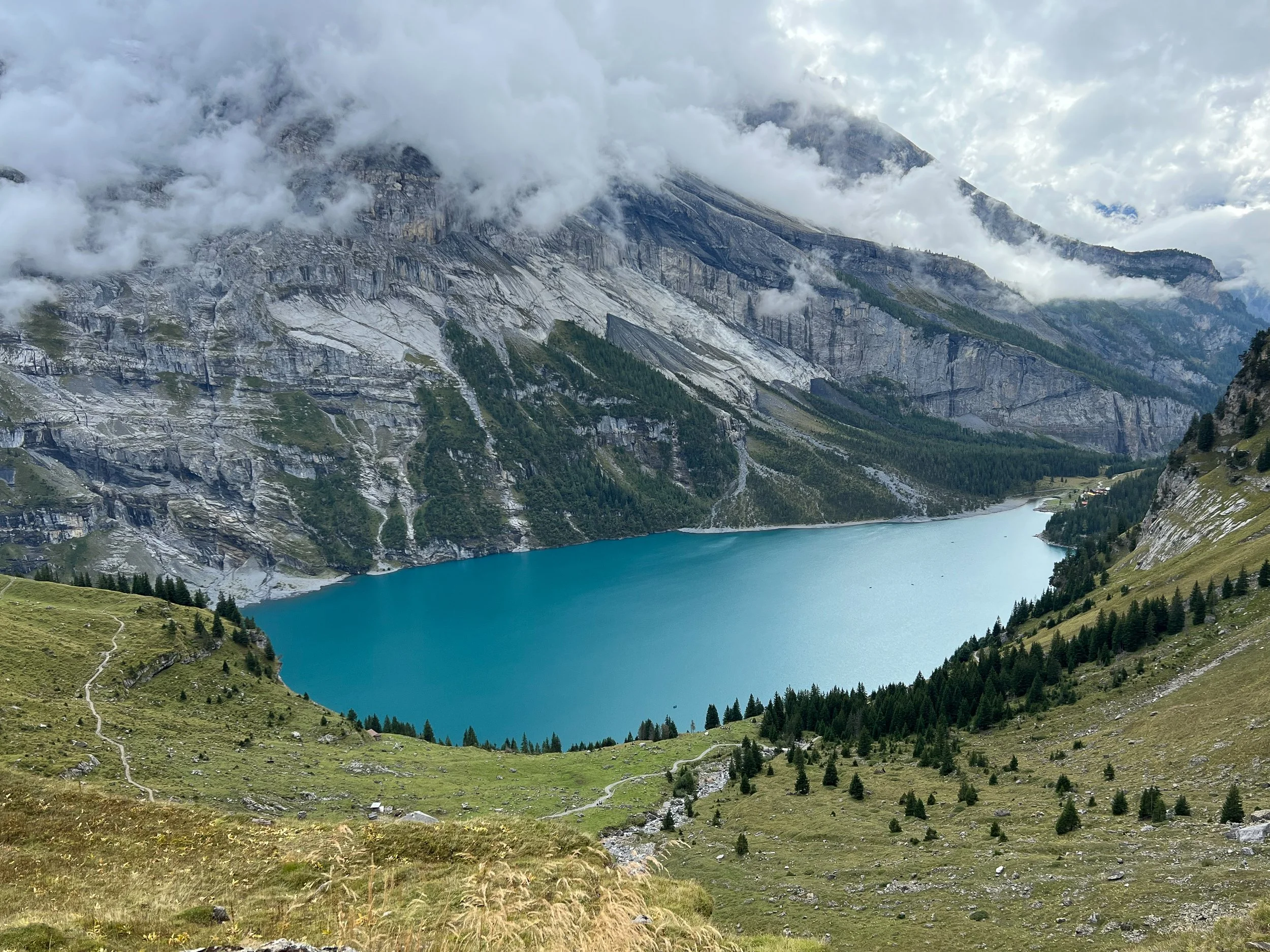
On the way down the Pass to Kandersteg is a farm stand located just above Lake Oeschinensee, a great place for a snack and tea or coffee before making the rest of the journey downhill to Kandersteg. Lake Oeschinensee is a beautiful body of water the color of turquoise located at the base of a towering mountain cliff. There is a restaurant located at the lake that is very well attended by tourists. Row boats can be rented to take on the lake.


Kandersteg to Leukerbad
The walk from Kandersteg to Leukerbad was my last full day of hiking. This trail involves going over Gemmi Pass, which is long and relatively flat compared to the passes I’d already gone over. Due to some discomfort felt in the big toe of my left foot after the steep decline from the previous passes, I decided to take the Kandersteg-Sunnbuel tram to Gemmi Pass for the start of the hike. My Swiss Half-Fare Card came in handy for a reduced fare. Unfortunately I hit a rock while walking along the Gemmi Pass trail with the front of my left boot, jamming and further traumatizing the big toe. The toenail started turning black and blue, a sign that it is likely to eventually fall off, as of this writing.
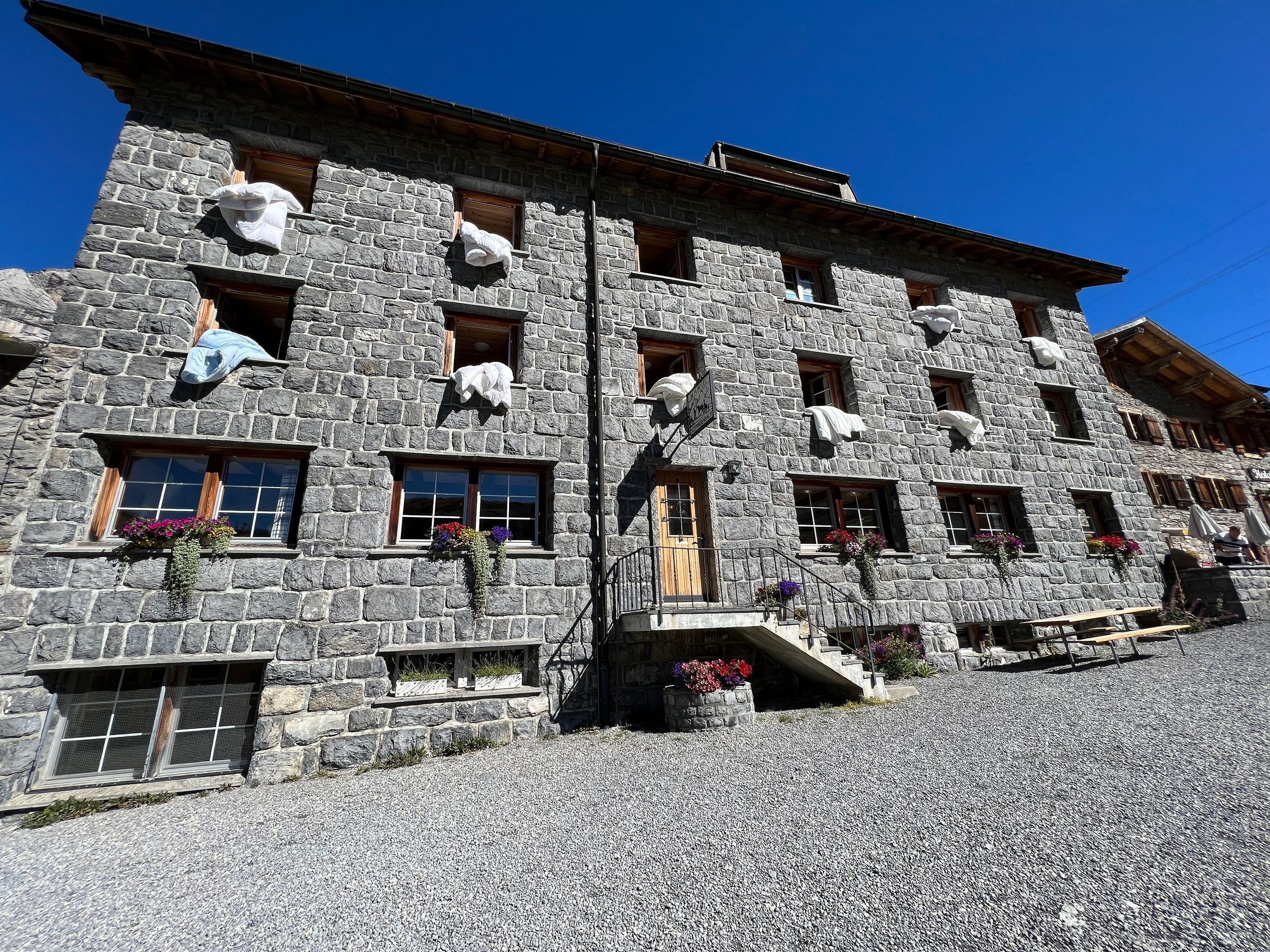
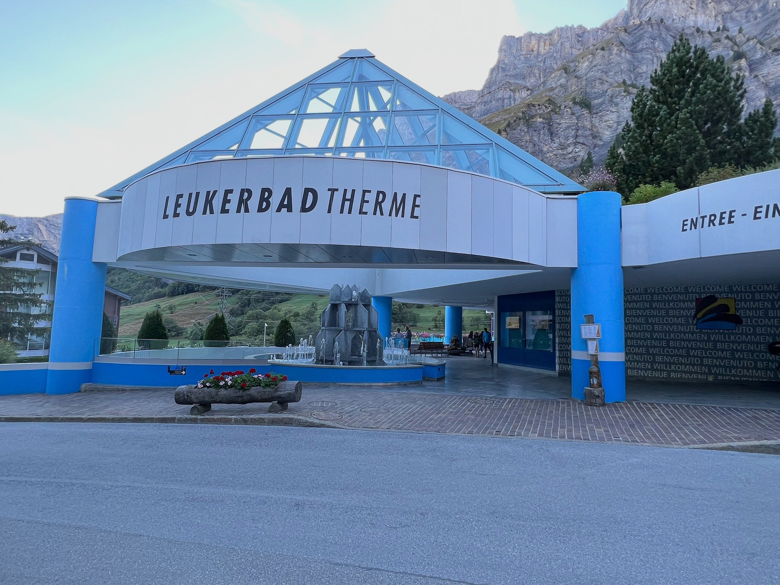
A big surprise at the other end of the pass overlooking Leukerbad was the Gemmi Lodge and Restaurant. I stopped for lunch and sat on the outdoor terrace, taking in a spectacular panoramic view of the Swiss Alps, with the Matterhorn in the distance. After lunch, I proceeded down the switchbacks carved out of a cliff wall to Leukerbad. The town has a thermal spa that was quite popular, but due to my swollen toe, I stayed away from any hot water from an otherwise inviting looking spa.


Zermatt
With limited days left, I took a bus from Leukerbad to Visp and then a train to Zermatt, which lies near the foot of the Matterhorn. Zermatt is a larger town than the others I had visited. It was also more touristy, but for good reason. The Matterhorn has attracted people from all over the world for many years, including climbers. But not all climbers have been successful in a safe ascent and descent of the the Matterhorn. Behind the St. Mauritius Catholic Church in the center of town is a graveyard of climbers who died on the mountain. Some of the grave stones are included in the photos below. The town offers many stores for outdoor apparel, chocolate, accommodations and eateries. The town also has a small enclosed area that offers showers and WiFi for those who don’t have deep pockets and are willing to camp with a tent.
Having a day and a half in Zermatt, I used the initial half-day to take the Gornergrat Bahn (cog train), considered Europe's highest mountain railroad, to RIffelberg, one of the stops along the way to Gornergrat, and hiked the rest of the way to the top. The elevation at the top is almost 10,300 feet above sea level. The air got to be rather thin at that elevation, which added to the challenge of reaching the top. The terrace at Gornergrat offered clear views of the Matterhorn and nearby glaciers.
I used the remaining full day to walk around Zermatt, visiting the historic part of town and learning about Ulrich Underbinen and Peter Taugwalder, legendary climbers from Zermatt.
Like some other towns that I had visited on this trip, there was no car traffic in the center of town. Hotels have miniature vans to take travelers to and from the hotels and the train station. The Fuchs Bakery and Bistro is a great place to stop to enjoy some of their delicious pastries.


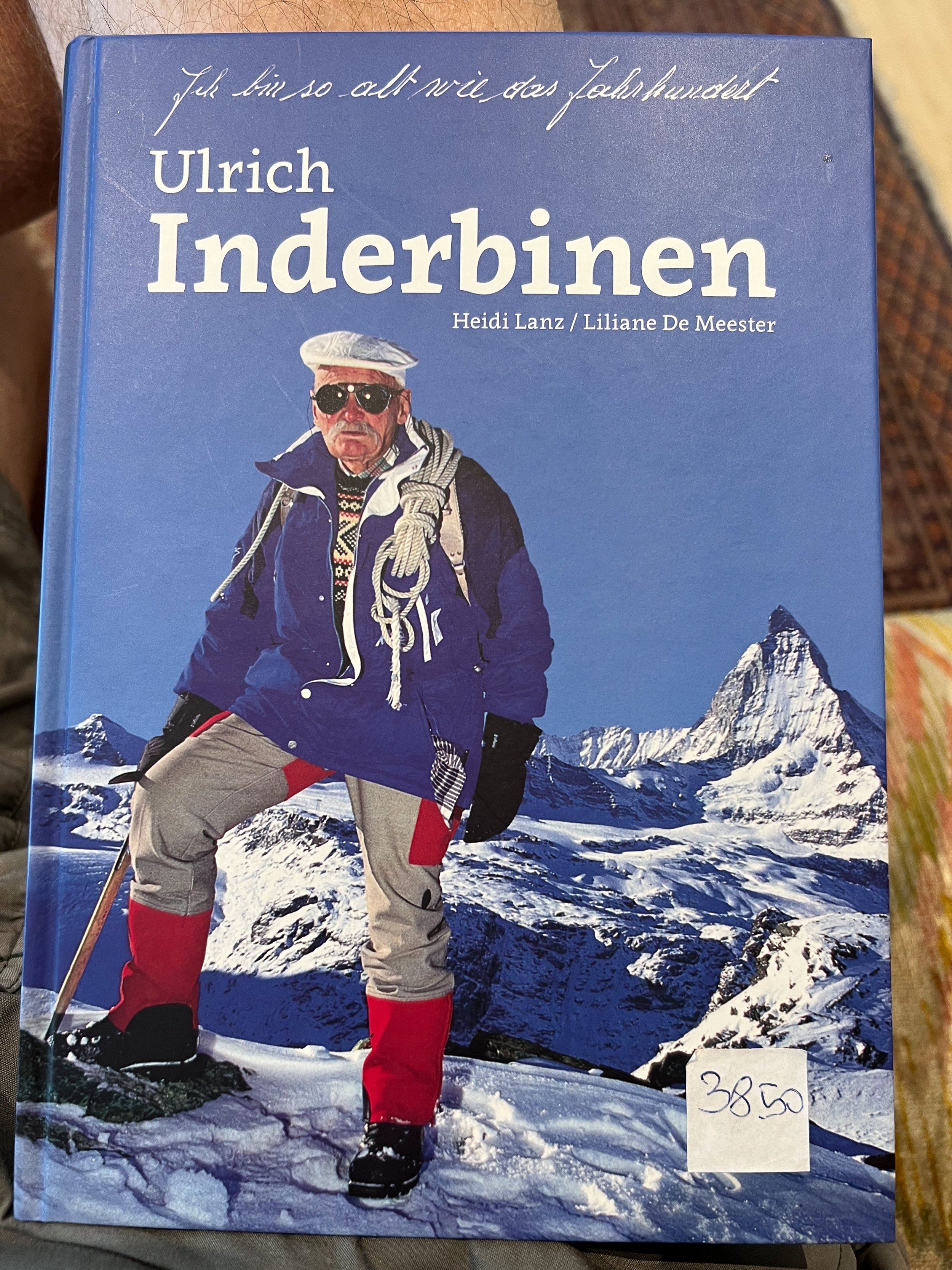


Ulrich Inderbinen, a resident of Zermatt, reportedly climbed the Matterhorn 370 times as a guide. His last climb was when he was 90 years of age! He was born in 1900 and passed away in 2004. A book (in German) was in the hotel lobby of where I stayed. A fountain with a relief of Inderbinen is located in the historic district.
Peter Taugwalder was the first to climb the Matterhorn in 1865. He had a son, also named Peter. During their first ascent, four people died while coming down from the mountain. The safety rope snapped. People were critical of both Taugwalders for the disaster. The Taugwalders left Zermatt amid the controversy and the father and son only returned years later. In 2005, a rope, similar to the one used on the fatal trip, was tested and found to be insufficiently strong to hold the number of people who fell to their death. The test was, in some part, a vindication for the Taugwalders, but they had both passed away by the time the rope test was made. A plaque is mounted on the face of the house where they lived. Behind the St. Mauritius Catholic Church is the Climber’s Cemetery that includes a memorial stone to the Taugwalders. Most of the stones were for climbers who died on the mountain.
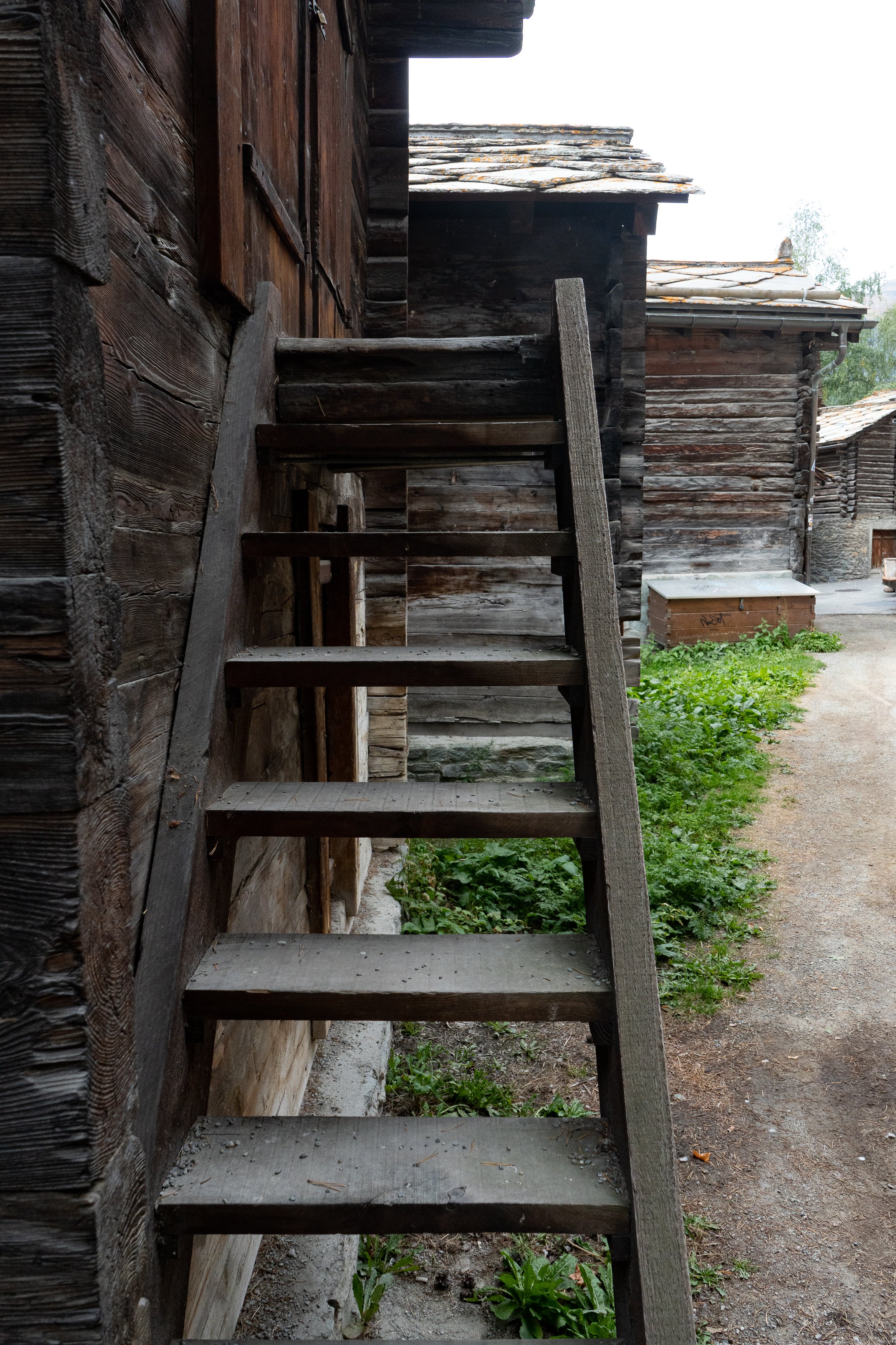
The photos, below, are old wooden buildings located in the historic district of Zermatt, some dating back to the 16th century. Some had pens for livestock located below the living quarters. The round, flat stones on the stilts were intended to prevent unwanted animals finding their way into the living quarters.
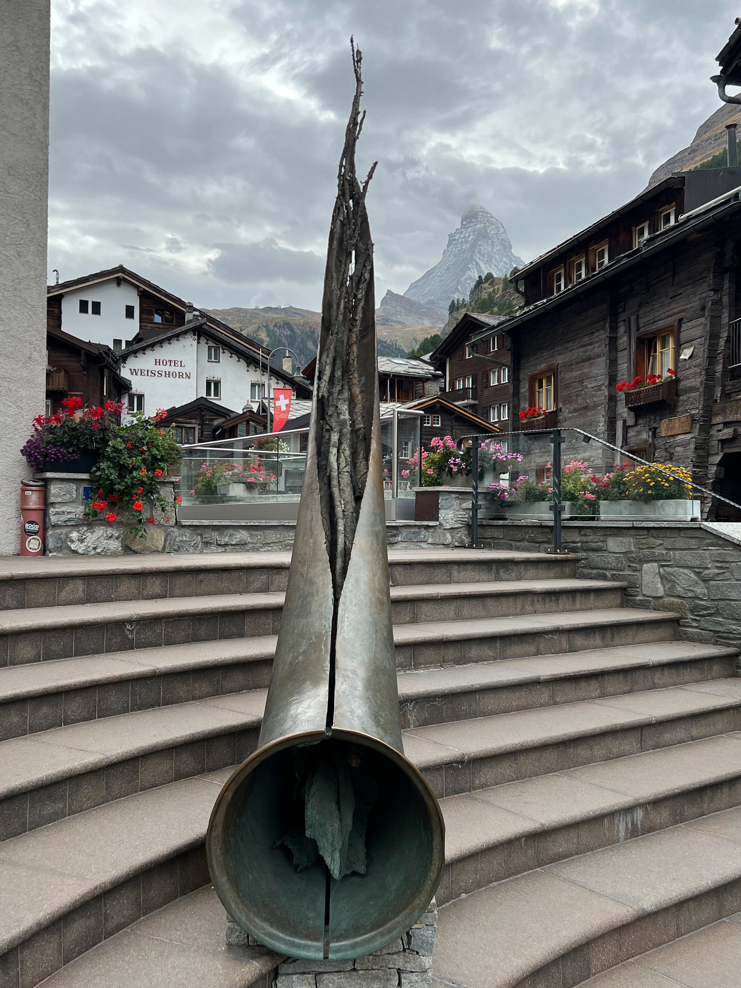
A Swiss Alphorn (now serving as a sculpture) located by St. Mauritius Church.
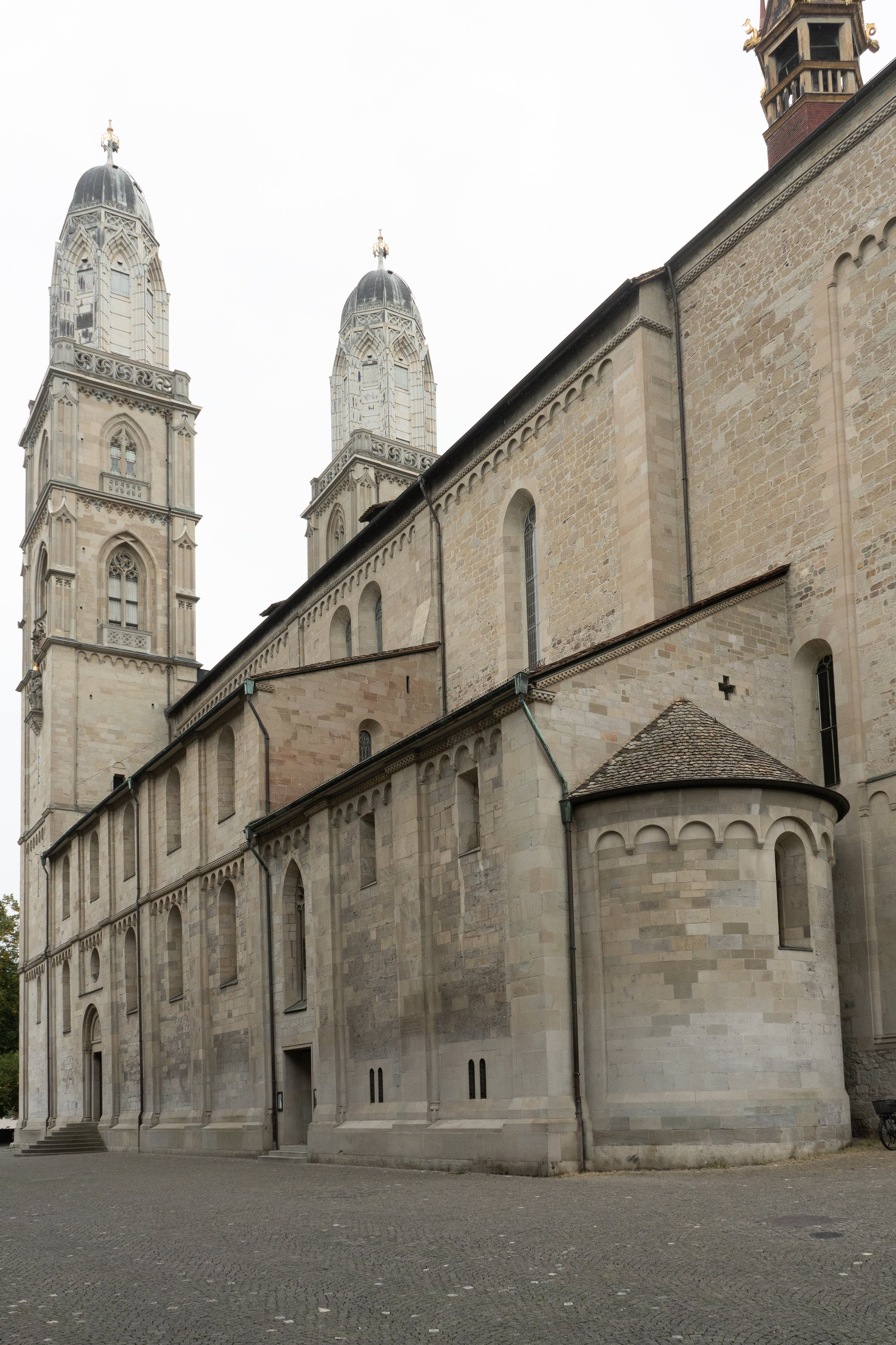
Zurich
I flew in and out of Zurich and decided I would allow part of a day to explore the city. These are some photos while roaming the streets during the time I had available to me before my departure.

Heinrich Bullinger was a leading 16th Century Reformer in Switzerland and associated with Calvanism/Protestanism. He was pastor at Grossmünster. His statue is mounted on the external wall of the church.

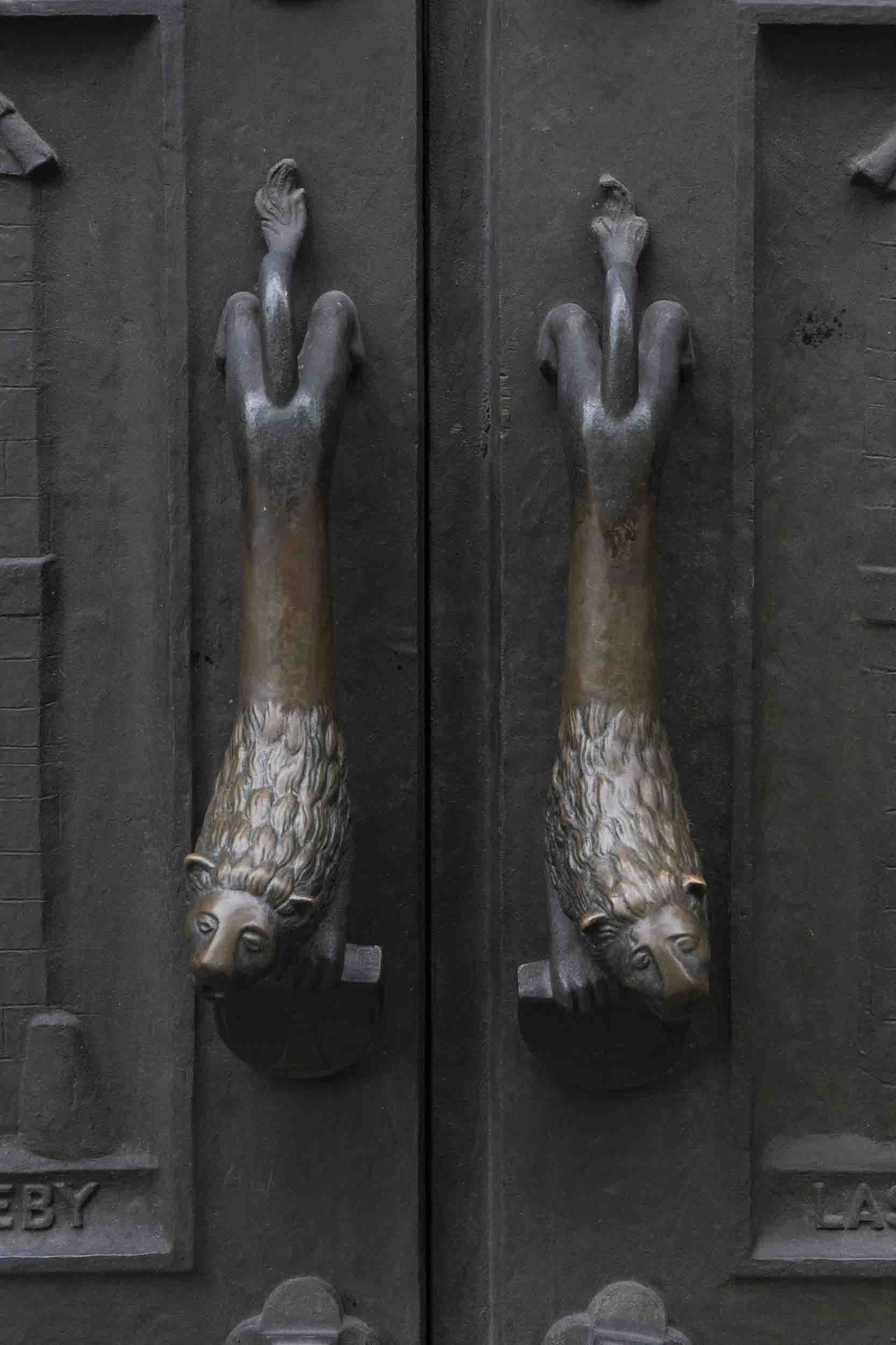
The amazing reliefs on two sets of doors to Grossmünster are reminiscent of the bronze doors with relief sculpture of the Baptistry of the Duomo in Florence Italy.


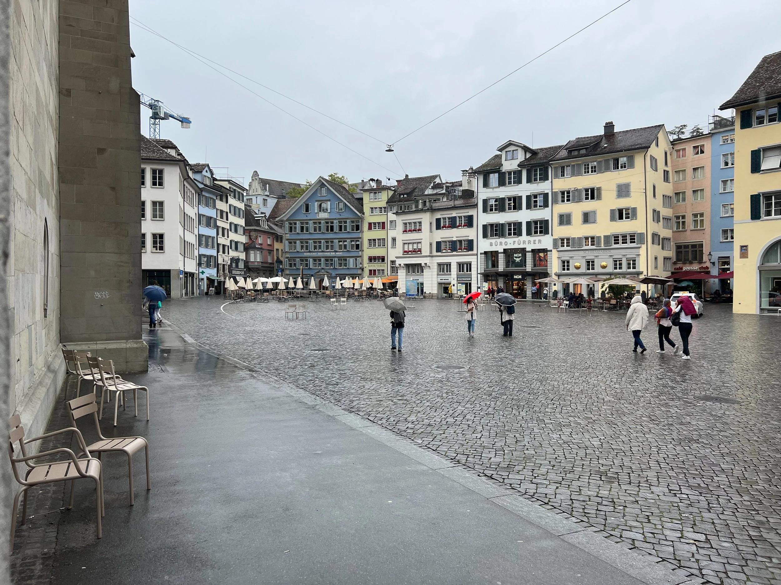


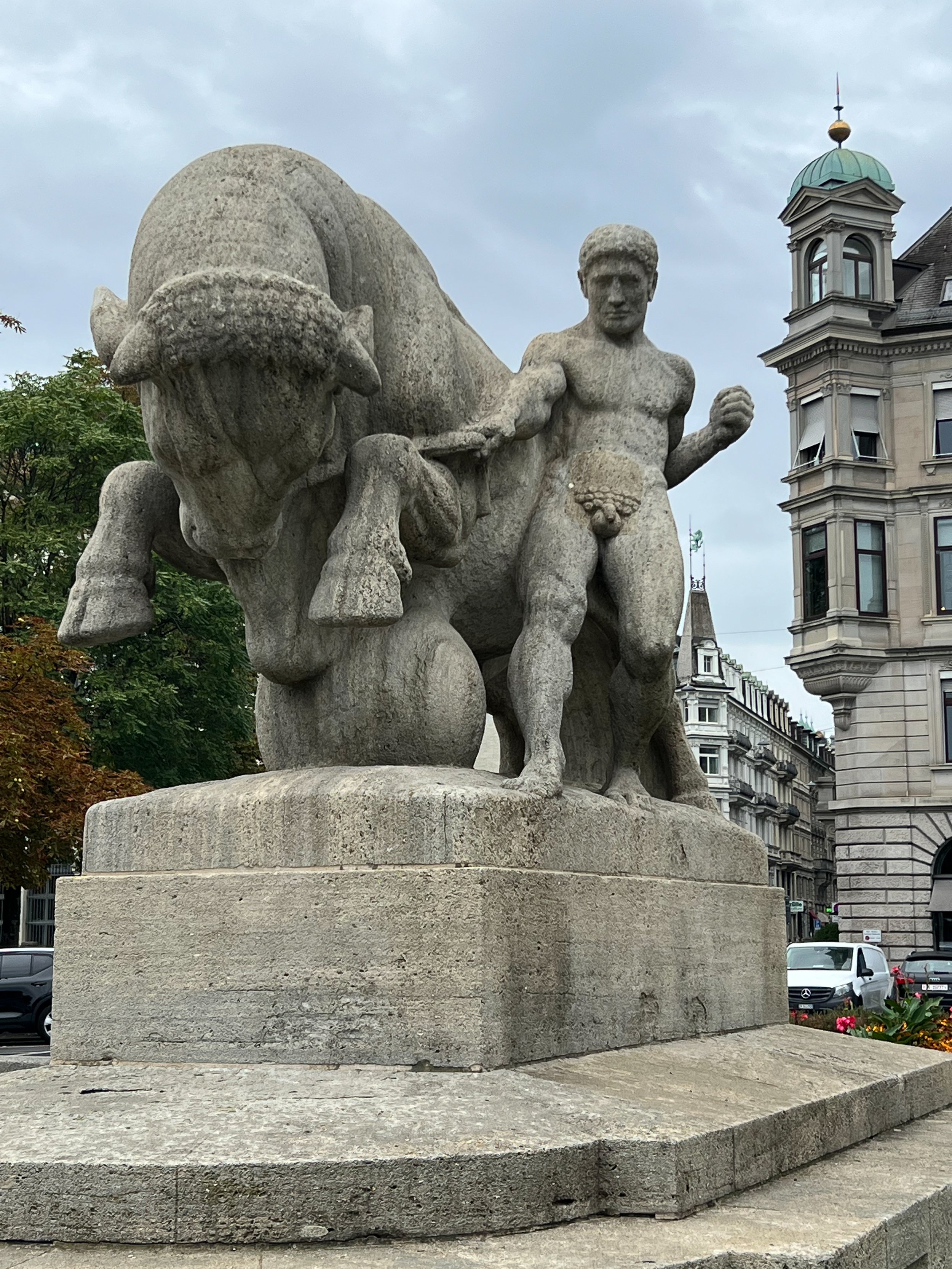
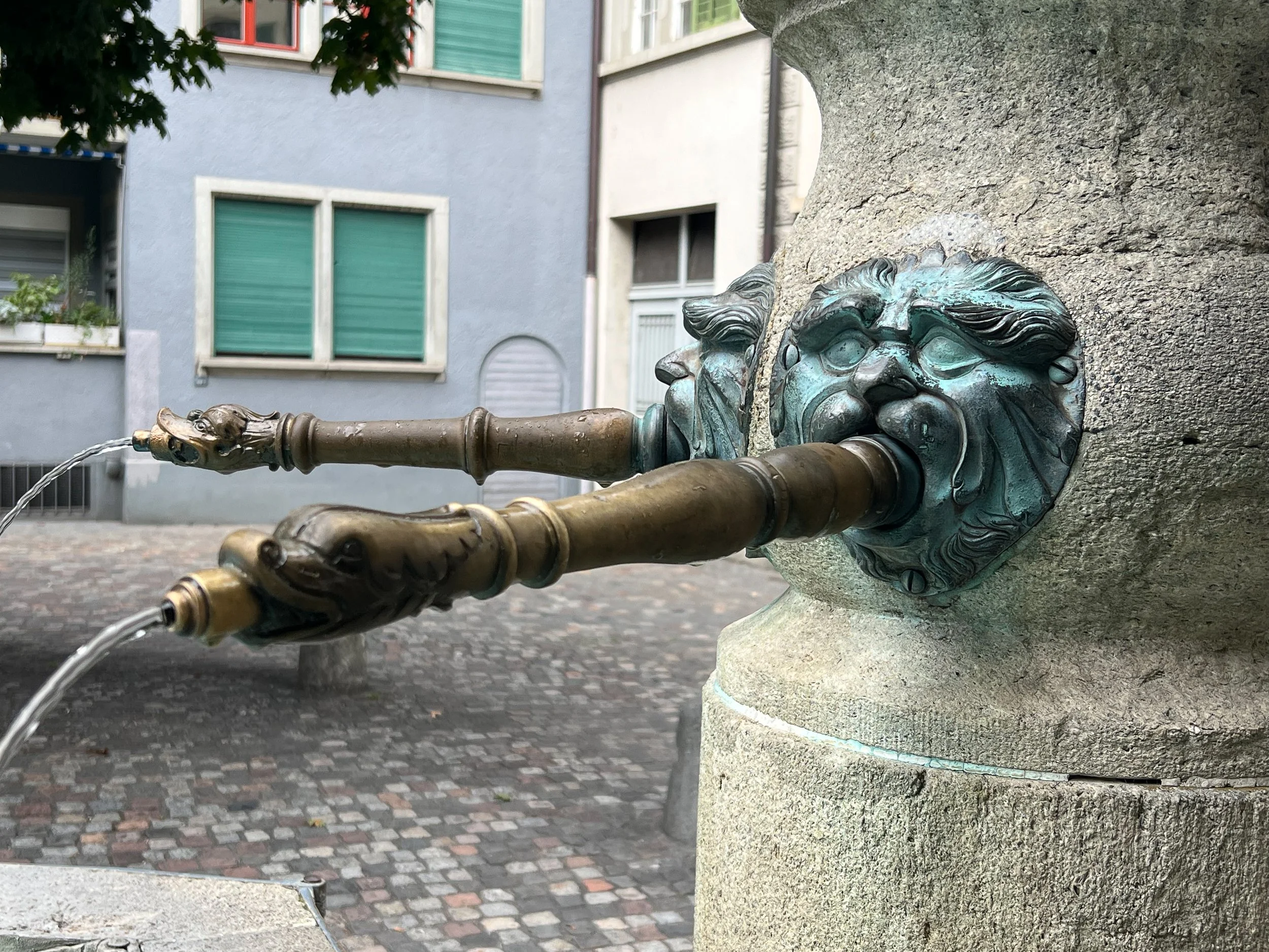
Other scenes from Zurich.